Cooler end to the week; Heat builds in for the 4th
Hit and miss showers and thunderstorms are happening Friday morning in southeast Nebraska. Thunderstorms have been north of I-80. Showers have been located in southern Nebraska along the Highway 136 corridor. In between, along I-80, rain has stayed away.
Scattered showers and thunderstorms will remain possible through mid-morning. An isolated shower will remain possible through the afternoon.
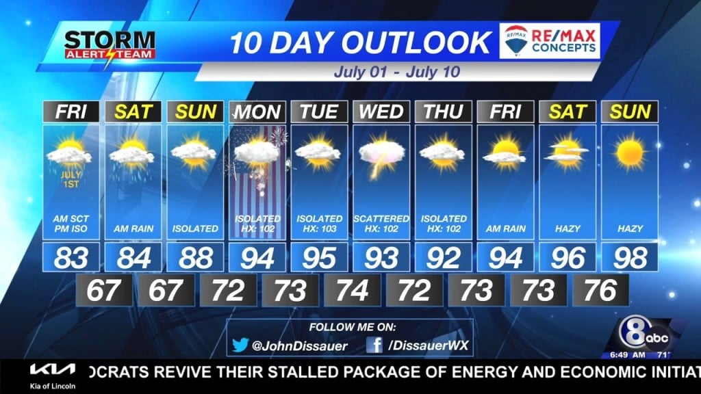
An impact for everyone Friday will be cooler air setting up in the region. Highs will be 10° to 15° cooler than Thursday – topping out in the lower 80°s.
Rain returns to southeast Nebraska for the start of the holiday weekend. Energy will bring showers and thunderstorms Saturday morning, starting near daybreak. Rain should taper off by late morning, leaving mostly cloudy skies for the remainder of the day. Temperatures will also remain below normal as highs will be in the middle 80°s.
Humidity starts to increase starting Sunday as dew point temperatures will climb in to the upper 60°s. Low-level moisture will continue to climb in to early next week. Dew points are expected to be in the 70°s starting the 4th of July. Along with high temperatures in the 90°s, the heat index is projected to breach 100°.
BUILDING HEAT
Long range computer models suggest an upper-level “hot dome” establishes over the western United States for the end of next week.

This could send temperatures in to the triple digits over many states in the western Plains and the desert southwest.


