Cooling down for the weekend
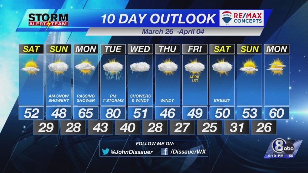
The weekend is going to bring cooler than normal temperatures and even a chance for a little snow.
After a chilly start Saturday morning, skies will quickly turn partly cloudy. Temperatures will warm in to the lower to middle 50°s. Winds will be out of the north, shifting to the northeast, 5 to 10 mph.
Clouds will increase late Saturday night in to Sunday morning. High resolution computer models are picking up on the possibility of light precipitation developing along a narrow northwest-to-southeast oriented corridor. Temperatures at the surface will be in the upper 20°s (below freezing). Go up a few thousand feet and the air will be a degree or two below freezing. That means there will be a chance for snowflakes to develop as the moisture falls to the surface.
At this point it does not appear to be enough to amount to much on the ground but keep up with the forecast from Meteorologist Malcolm Byron this weekend in case there are any changes.
– Chief Meteorologist John Dissauer


