Mostly clear for Friday, showers possible south
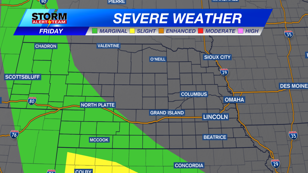
We are monitoring the chance of severe weather across the western portion of the state for Friday. There is a marginal risk (level 1 out of 5) through the panhandle and the southwest corner of Nebraska. The main hazards associated with any storms today are small chances of large hail and damaging winds. Storms are expected to track along the southern border of the state throughout most of the day.

The high temperature in the capital city today is expected to reach 90 degrees with a light breeze out of the west southwest. Mostly clear skies are expected throughout the afternoon with a chance of seeing a stray shower around dinner time tonight.

Temperatures across the region will be near average in the mid to upper 80s with light winds out of the west southwest.

Mostly clear skies ahead for the weekend with mild temperatures in the middle 80s continuing into next week. Our next chance at precipitation will come on Tuesday night into Wednesday morning. Following the rain chance, temperatures will be in the upper 80s accompanied by mostly clear skies for the rest of next week.

Storm Alert Team Meteorologist
Dominic Ferraro


