Rain and snow starting Monday evening
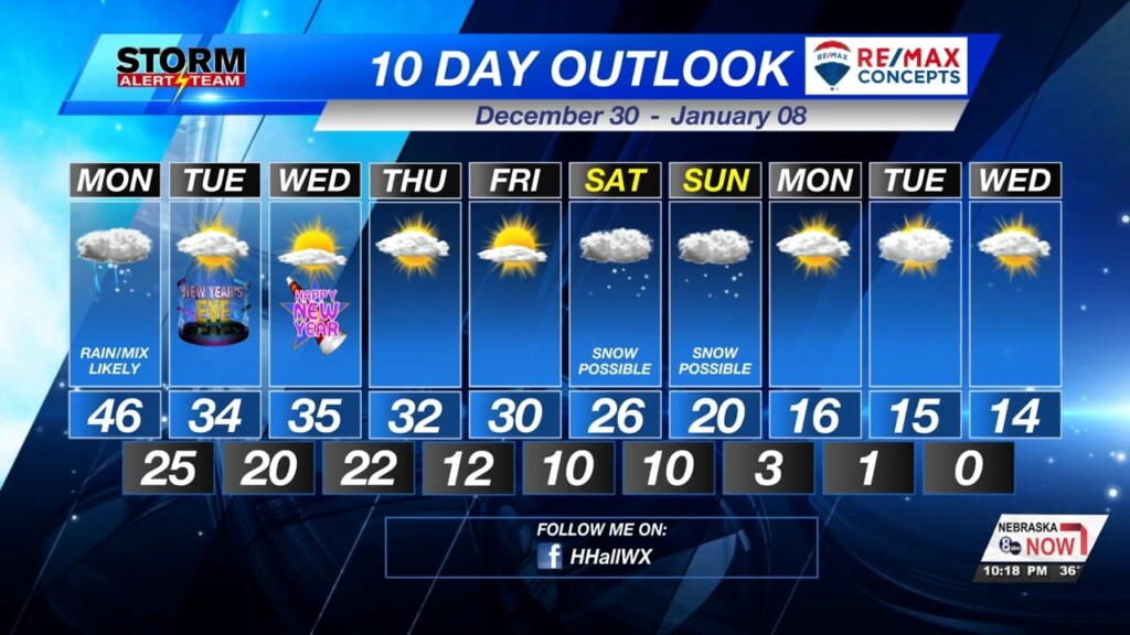
Snow is possible for much of the state through Tuesday morning, but we’re not expecting a lot . 2-4″ is possible for the northern portions of the state. 1-2″ is possible in a swatch from north of Lincoln to Omaha and counties north of Grand Island. South of there, just a trace to half an inch of snow is possible. There is uncertainty on the ground/pavement temperatures which would melt most of the snow and prevent it from accumulating, whereas the colder temperatures would allow snow to stack up. We will keep you updated through tonight and tomorrow morning.

Below is what StormCast has for the timing of the rain and snow. Most of this will be out of our area by late Monday night.
Tonight, temperatures in the lower 30s for most of us.

Monday, temperatures in the low to mid 40s. This could affect how much accumulating snow we will see. Most of us will likely see snow that turns into rain as it gets closer to the ground.

Monday, rain/snow mix likely in the evening and late night hours. Temperatures in the 30s through the week. Some snow chances possible Saturday into Sunday morning, but too far to call. A big cool down starting next Sunday with temperatures getting into the teens.

Meteorologist Houston Hall
Facebook: HHallWX


