Severe Thunderstorm Watch in effect Tuesday Night
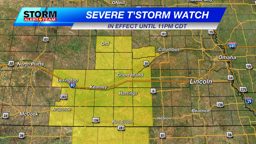
The National Weather Service has issued a Severe Thunderstorm Watch for portions of south central Nebraska. The watch is in effect until 11 p.m. CDT Tuesday night.
As of early Tuesday evening, thunderstorms are beginning to develop along a dry line that extends from Lexington to Holdrege to Alma. The line will likely build further south in to north central Kansas.
The initial main threat from thunderstorms will be large, damaging hail. As we go through the evening and in to the night the main threat will transition to damaging winds from collapsing thunderstorms. I also can’t completely rule out the chance for a tornado, mainly along the Kansas/Nebraska state line from Red Cloud to Alma.
As we get further in to the night thunderstorms should begin to weaken. Rain should be out of the KLKN viewing area by midnight, although I can’t rule out a widely scattered shower and/or thunderstorm overnight.
An area of low pressure currently in southwestern Nebraska/northwestern Kansas will move east, pushing a cold front through southeast Nebraska overnight. Winds will shift from the south/southeast Tuesday to north/northwest. Winds will continue to gust 25-30 mph overnight. This will allow cooler air in to the region as low temperatures drop to the upper 30°s to middle 40°s.

Scattered showers will remain in the forecast throughout the day Wednesday. Combine that with cloudy skies and winds gusting to 40 mph (out of the north/northwest) and it is going to feel MUCH cooler than the previous few days. High temperatures will only be in the middle 40°s to middle 50°s.
– Chief Meteorologist John Dissauer