Snow showers possible overnight
The weather system that brought warm weather to southeast Nebraska Tuesday is now moving through the Great Lakes region. Behind it, winds have shifted out of the northwest and colder air has arrived. So much colder, in some parts of southeast Nebraska it is 40° to 45° cooler than Tuesday evening.
It is going to feel more like winter for the overnight and Thursday morning. Skies will remain overcast and winds will gust to 30 mph out of the northwest. The air temperature will drop to the 20°s for overnight lows. Factor in the wind and wind chills will be in the teens. Don’t forget your jacket in the morning!
It may start to look more like winter for some Wednesday night. There will be just enough moisture in the air to produce a few rain showers, mainly north of I-80. As we go through the overnight, and temperatures drop, rain will change over to snow. Scattered snow showers will move south, out of the state, by 4 a.m. to 5 a.m. Thursday.
Those that receive snow should not expect for much to accumulate. I am not expecting anymore than a dusting on roadways. There could be a few tenths of an inch on elevated surfaces and grass.
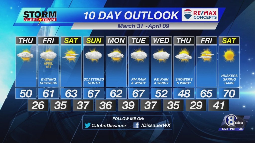
Thursday will start with cloudy skies. Clouds should quickly erode from the west through the morning. Skies will become mostly sunny for the afternoon. It should be a touch warmer Thursday afternoon with highs in the the lower and middle 50°s.
– Chief Meteorologist John Dissauer


