Thunderstorms possible through early Wednesday morning
Thunderstorms will develop Tuesday evening on the back side of a cold front that is draped over southeast Nebraska.
As we go through the night, thunderstorms will begin to expand in coverage while moving north/northeastward.
Initially, a few of the thunderstorms could become strong/severe. The initial main threat will be large hail and an isolated tornado. As we go further into the night, the threat transitions to damaging wind.
There is also some potential for minor flooding if thunderstorms train over the same area for several hours.
The threat for storms comes to an end in Lincoln after about 2 a.m. Wednesday.
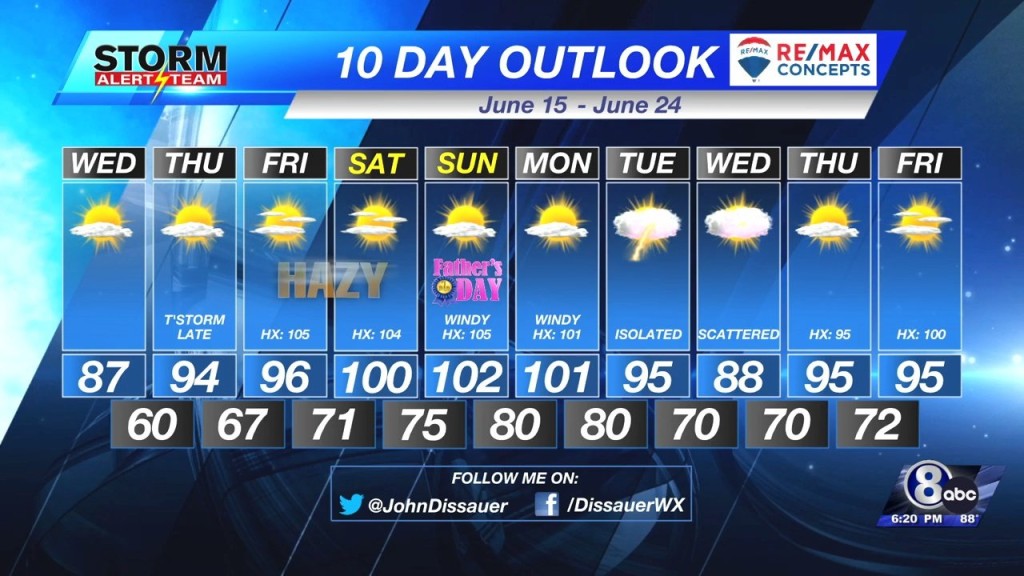
Wednesday will start out with clouds in the morning before turning mostly sunny by afternoon. Temperatures will be “cooler” with highs in the 80s.
Heat and humidity build back into Nebraska for the end of the week and weekend. Temperatures will be near 100 and the heat index will climb as high as 105 on Friday and Sunday.
– Chief Meteorologist John Dissauer


