VIDEO: New drone program will help NSP on crash investigations
The new program is being used by Crash Reconstruction Investigators throughout the state.
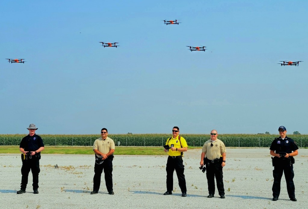
LINCOLN, Neb. (KLKN) – A new drone program, designed to get roadways cleared faster after a crash while still doing a thorough investigation, was launched by the Nebraska State Patrol.
The new program is being used by Crash Reconstruction Investigators throughout the state.
“This is a major step for our team, combining new technology with the expertise already possessed by our crash reconstruction investigators,” said Colonel John Bolduc, Superintendent of the Nebraska State Patrol. “The goal of this program is to be able to clear crash scenes faster, while maintaining the high-level of investigations our troopers already perform. Clearing a scene faster means roads can open sooner, saving time and money for travelers and the trucking industry, and hopefully preventing secondary crashes.”
According to NSP, Crash Reconstruction Investigators have completed the Federal Aviation Administration’s Part 107 certification as Unmanned Aerial Vehicle operators. These troopers have also undergone specific training to utilize the UAVs for 3-D mapping of crash scenes.
“This technology brings NSP crash investigations to a new level,” said Lieutenant Brent Bockstadter, program coordinator. “Our investigators work to create the best possible visual representation of a crash scene. The new drones, coupled with state-of-the-art mapping systems, allow our investigators to gather investigative images and data in less than half the time it used to take.”
Throughout the state, NSP has 19 certified drone pilots. The Nebraska State Patrol says training flights and reconstruction mapping tests have already been done at Husker Harvest Days near Wood River in recent weeks and the program has been used to investigate several crash scenes already across the state.