Warming trend ahead in Nebraska
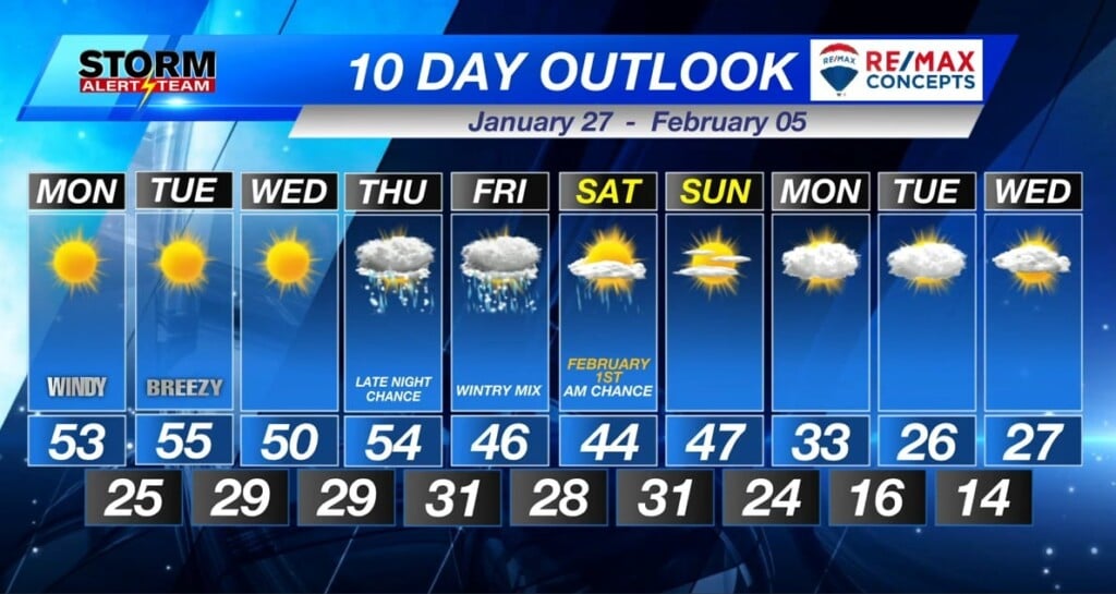
Downslope winds from the west/southwest on Monday will gust to over 30 mph at times, bringing us a warming trend as highs climb into the 50s for the next several days.
A ridge of high pressure sliding through our part of the country will eventually move out of the picture later this week as a large upper-level low currently impacting California builds strength over the Four Corners region of the southwest U.S.
By late Thursday night, this storm complex will move into the Central Plains, with some models expecting the area of low pressure to end up in the Texas Panhandle while the GFS indicates a possible wave extending into northeast Kansas.
Winter storms are extremely difficult to predict so we’ll have to adjust forecasts accordingly throughout the week ahead.
In the meantime, enjoy the warmth as we wrap up January, with February starting out with a much colder forecast.
Storm Alert Team Forecaster
Kent Boughton


