Winter Storm Conditions Thursday
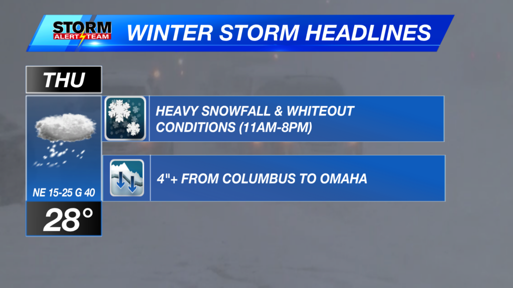
Afternoon & evening plans or commutes will be impacted! MOD/HEAVY blowing snow bands will occur with the heaviest snow & whiteout conditions: 11am-8pm. A sharp cutoff on where the heavy band of 4″+ of snow ends up. Models have kept it slightly north from Columbus to Omaha. Expect BLUSTERY conditions all day with feel like temperatures near 0 to -10 degrees. Snow will be linger into early Friday morning.


Moderate/heavy snowfall will occur farther west through 3pm. By 11am, peak winter storm conditions will begin. Snowfall rates up to 1″/hr. will occur within the heaviest bands near Broken Bow, Ord & Albion near noon. Lincoln, Grand Island & Omaha will start to see conditions ramp up near 2-4pm. Expect accumulating snow to begin at this time and continue through 11pm.
Best chance for 5-6″ will be into Cherry county and near Mullen, Broken Bow. A sharp cutoff on where the heavy band of 4″ of snow ends up. Models have kept it slightly north from Columbus to Omaha. SE Nebraska will likely see a T-1″. Farther north Lincoln will likely see 2-3″+ of snow starting Thursday evening.

Winter storm conditions all through Thursday across Nebraska. Heaviest snow from Cherry county to Broken Bow & east near HWY 20. Snow on the ground will keep us cold and blustery through the weekend. By Tuesday, temperatures warm back up into the 40s and 50s. Tracking a small chance for precipitation late next week into early March. Stay safe out there!

Meteorologist Houston Hall
Facebook: HHallWX
YouTube: HHallWX


