Hot Tuesday With Late Storms
Peak afternoon temperatures reaching the 80s & 90s with a warm front stalling from O’Neil down to SW Nebraska. This will play a role into severe weather Tuesday night.

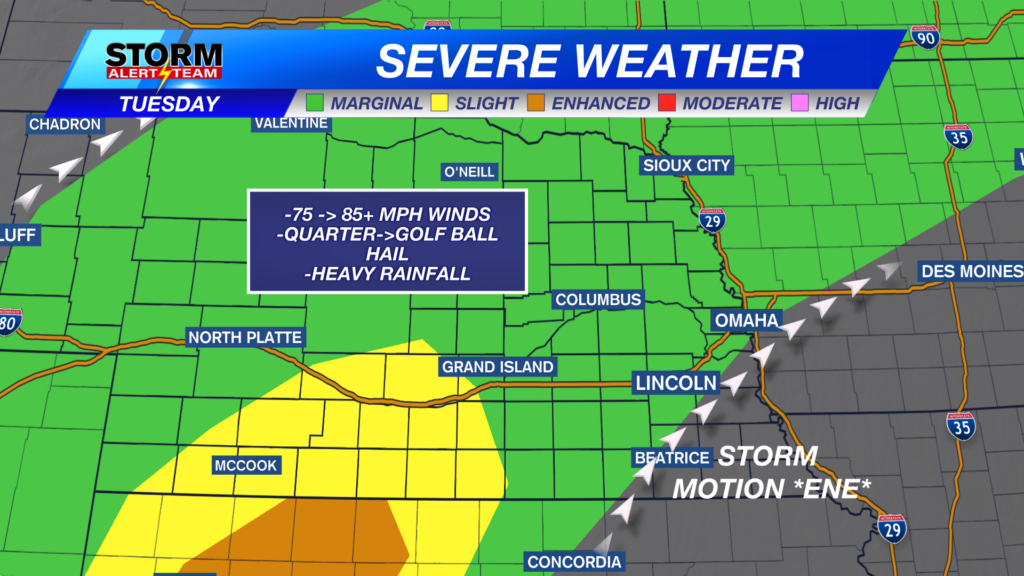
Dew points will fall along a sharp line. The severe weather & storms will likely form from SW Nebraska to NE Nebraska along the moist line.

75-85+mph wind gusts will be possible from areas east of McCook & north of I-80. Localized gusts could exceed 85+ mph like we saw Monday night.

10pm-midnight: Storms will develop near 10pm from Imperial->Broken Bow. Storms will move ENE through the overnight, carrying a DAMAGING WIND & HAIL threat. UNCERATINTY: SE Nebraska could see some rain, storms & WIND near 10pm-1am. Stay tuned for the latest.

The DAMAGING WINDS look to enter our southern counties near 9:30-11pm. Some could see peak gusts up to 85+ mph.

1-3am: Winds up to 70-80+mph possible near 1-3am for areas around Ainsworth & O’Neil.*Storm motion will be ENE*

Tuesday will be another hot, breezy & partly sunny day with overnight rain & storm chances north of I-80. This pattern will continue through July 4th. Watching July 4th closely as our next cold front approaches. This could bring storms & gusty winds into Saturday evening & night. Stay up to date through this week.

Meteorologist Houston Hall
Facebook: HHallWX
YouTube: HHallWX

