Storm chances and heat sticks around
The heat and humidity remains in the forecast for the next several days. Storm chances are in the forecast, as well.

The Extreme Heat Warning and Heat Advisory is in place through 9pm Tuesday night.

Storms will be pushing through the yellow shaded “Slight Risk” area tonight into the overnight.
Above is what our StormCast weather model is saying for timing, duration, and location of the storms.

Large hail will be possible with up to 1″ hail possible in the brown shaded area (above) and up to golf ball size hail in the yellow shaded area.

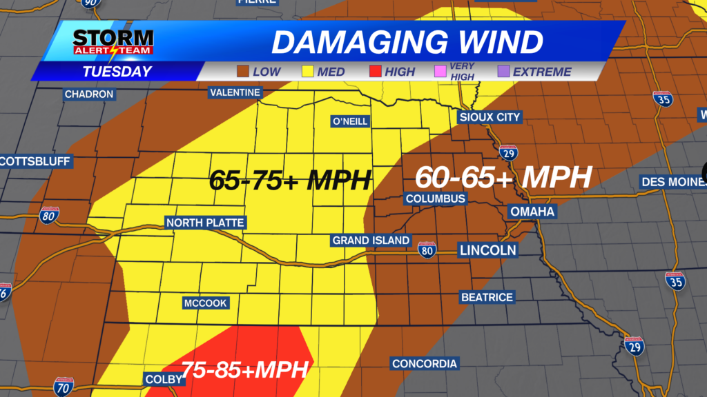
Damaging wind will be possible, as well, with up to 65 mph gusts possible in the brown shaded area, up to 70 mph in the yellow shaded area, and up to 80 mph in the red shaded area.

We remain very warm through Wednesday morning in eastern Nebraska with much cooler air for the western half of the state.

We do warm up into the 80s and 90s again on Wednesday, the first day of July.

Much of eastern Nebraska will see the middle and upper 90s for a heat index by the afternoon.

It remains hot through the 4th of July, then a storm chance will try to cool us off after that.
Chief Meteorologist Rusty Dawkins
Facebook: RustyWx
YouTube: RustyWx
TikTok: RustyWx
BlueSky: RustyWx
Instagram: RustyWx
Threads: RustyWx
Twitter: RustyWx