Storm Chances Increasing Through Saturday
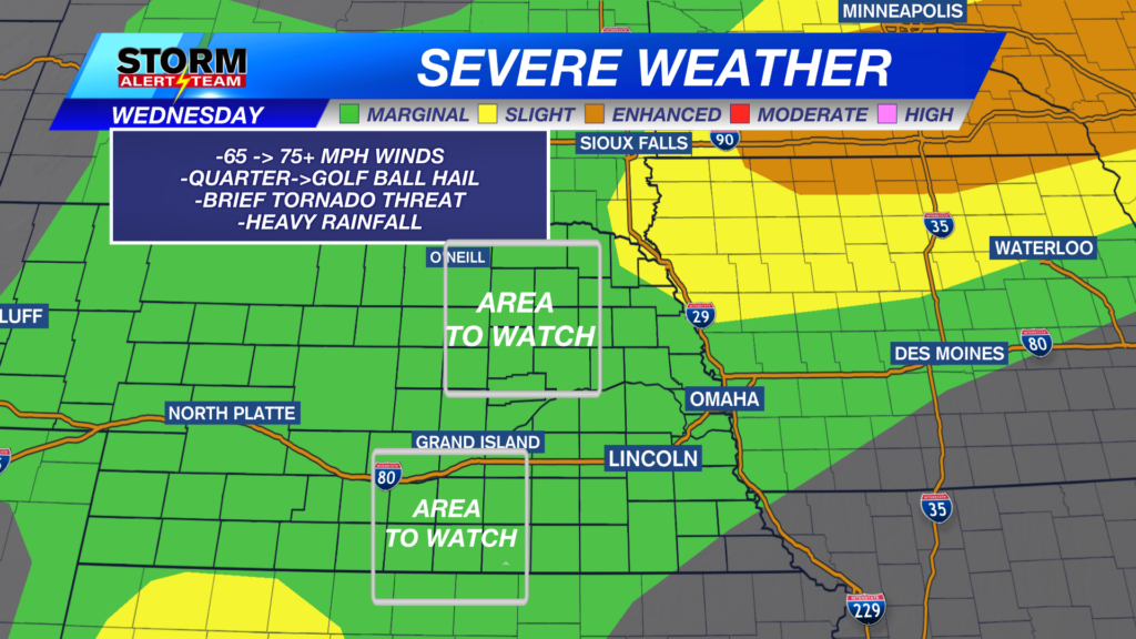
Main concerns with storms this afternoon/evening will be 65-75+mph winds, Quarter->golf ball hail & brief tornado threat. The STRONGEST storms could have winds up to 75+mph, hail up to golf balls, a brief spin up & heavy rain. *NE Nebraska best chance*

11-2pm: Isolated showers/T-storms will move east towards LNK & Omaha, carrying gusty winds up to 20-35+mph.

8-11pm: SW & north central Nebraska will start to see storms capable of STRONG winds, hail & a brief tornado.

11pm-2am: NE Nebraska will likely see strong winds, hail & flooding from midnight -3am.

FRIDAY SEVERE WEATHER: JULY 3, 2026

8-10pm: Earliest severe threat could start near 7-8pm, with all hazards possible, WINDS being main threat.

10pm-2am: This will likely be the PEAK time frame for SEVERE storms across eastern & SE Nebraska. 75-85+ mph winds, hail & a brief spin up within the line.

The system Friday night will limit storm chances for July 4th. Saturday evening could bring storms south of I-80, mainly SE Nebraska. Hot, Sunny and dry next week!

Meteorologist Houston Hall
Facebook: HHallWX
YouTube: HHallWX