Hot & Windy With late Storm Chances
Peak afternoon temperatures reaching the 80s & 90s with a surface front stalling from O’Neil down to near Alma. This will play a role into severe weather Tuesday night. Sunny skies farther west with windy & partly sunny condition in SE Nebraska.

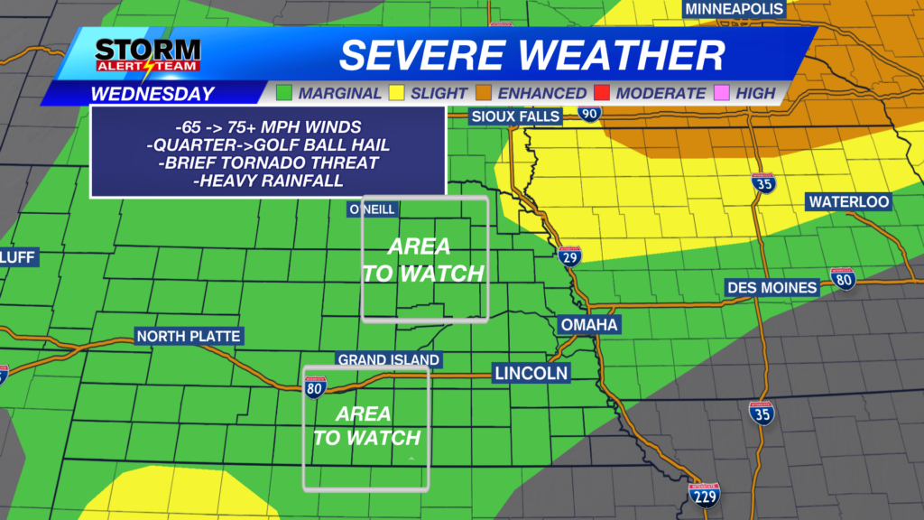
Dew points will increase out west along a surface boundary. The severe weather & storms will likely form east of McCook to NE Nebraska along the moist line of 70s dew points & instability.

SEVERE WX Wednesday

6-8pm: Storms will develop near from O’Neil->Alma. Storms will move ENE through the evening, carrying a DAMAGING WIND & HAIL threat.

9-11pm: Storms will move ENE, carrying winds up to 60-70+mph & hail up to golf balls for areas around Columbus & south of the tri-cities.

Wednesday will be another hot, breezy & partly sunny day with overnight rain & storm chances north of I-80. This pattern will continue through July 4th. Watching July 4th closely as our next cold front approaches. This could bring storms & gusty winds into Saturday evening & night. Stay up to date through this week.

Meteorologist Houston Hall
Facebook: HHallWX
YouTube: HHallWX


