More storms possible overnight, April 19-20, 2023
A Severe Thunderstorm Watch is now in place for SE and south central Nebraska through 7:00AM Thursday.

Strong to severe storms are going to be possible tonight into very early Thursday morning. Storms will form this evening and race east overnight. Large hail, damaging wind, and an isolated tornado will be possible.

The overall risk for severe weather are the areas shaded in green, yellow, and orange. The area with the highest risk is in the Enhanced Risk area, shaded in orange.
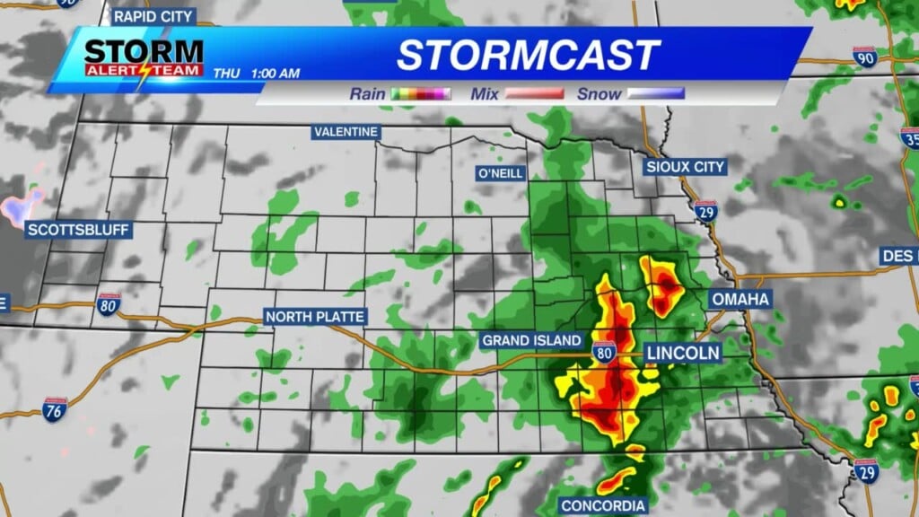
Above shows our latest model run of StormCast. It shows storms forming in south central Nebraska this evening and making it into eastern Nebraska by early Thursday morning.

The overall tornado risk is 2-5%. These overnight storms have a smaller (but not zero) chance for tornadoes than the earlier storms.

Large hail is going to be our main concern. Many areas may see 1″ in diameter hail, with isolated golf ball to baseball size hail possible in the red and yellow shaded areas.

Damaging wind is also going to be an issue with storms that form. Wind gusts in excess of 70 mph will be possible in the red and yellow shaded area.
Chief Meteorologist Rusty Dawkins
Twitter: RustyWx
Facebook: RustyWx
YouTube: RustyWx


