Quiet one more day, then things get interesting
Tuesday’s focus of Severe Weather Awareness Week is tornado safety. There is a lot of great information that can be found in this link.

A quiet day of weather is expected for Wednesday. A mix of sun and clouds with temperatures in the 60s.

It’ll be a little warmer the further west you go, too.

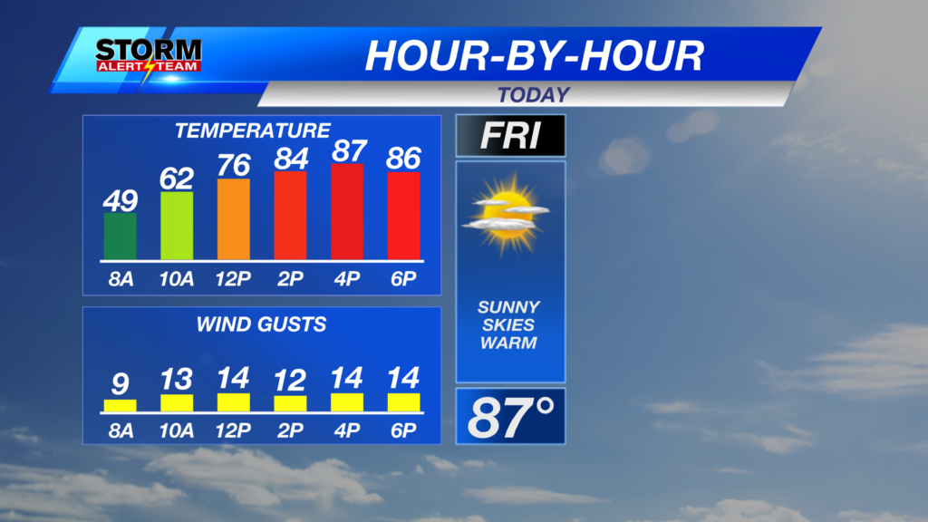
After above average temperatures on Wednesday, we’ll be WAY above average on Thursday and Friday.

For Thursday, we have a level 1 “Marginal Risk for storms.

That threat moves into eastern Nebraska Thursday evening with hail and damaging wind the main threats.

See below for timing of the storms from our StormCast weather model on Thursday, then the next storm/snow threat headed our way Sunday into Monday.
There is a chance for storms late Friday into Saturday, then a rain/snow mix possible into Sunday. Quite a bit going on over the next few days, so be sure to check back often for the latest!

Chief Meteorologist Rusty Dawkins
YouTube: RustyWx
Facebook: RustyWx
BlueSky: RustyWx
Instagram: RustyWx
Threads: RustyWx
TikTok: RustyWx
Twitter: RustyWx