Storms likely tonight into Wednesday morning
A Severe Thunderstorm Watch is in place until 11:00pm CDT for the western half of the state.

Strong to severe storms are possible Tuesday night into Wednesday morning.
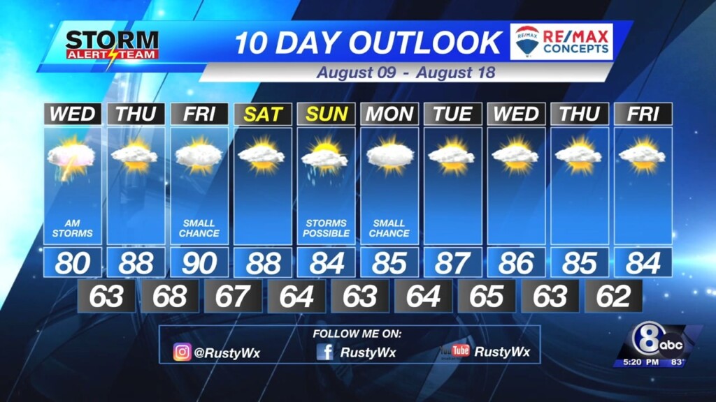
The forecast above is a detailed play by play for what may happen tonight. If you’re looking for just a quick forecast, then check out the graphic below!

Storms will start in western Nebraska and will push east overnight. Above shows the timing of when storm will be in different parts of the state.

The threat for a tornado is small, but those in SW Nebraska and the panhandle do have a chance early.

We all have a chance for hail with the better chance for hail bigger than 2″ in the area you see the black dashes.

Damaging wind will also be an issue. The area with the black dashes may see wind gusts over 70 mph.
Chief Meteorologist Rusty Dawkins
Twitter: RustyWx
Facebook: RustyWx
YouTube: RustyWx


