Up and down temperatures this week
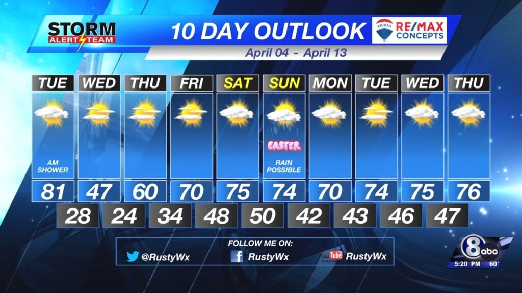
Temperatures are going to be all over the place this week. Very warm Tuesday, then cold on Wednesday. Precipitation chances for SE Nebraska remains limited.

Upper 70s and lower 80s for the southeastern half of the state, 20s and 30s for the northwestern half on Tuesday!

The wind will be an issue in the afternoon. Wind gusts will be in the 30 to 40 mph range.

Snow will be an issue for the northwestern corner of the state. Many weather headlines are in place.

Winter Weather Advisories (purple), Blizzard Warnings (red), and Winter Storm Warnings (pink) are in place through Wednesday. Many inches of snow and a lot of wind is likely in this area. In eastern Nebraska, some showers will be possible Tuesday morning.

By Tuesday evening, a line of storms will be possible in extreme SE Nebraska, eastern KS, NW Missouri, and Iowa. This line will quickly move east overnight.

Because of this threat, extreme SE Nebraska is in a Marginal and Slight Risk for severe storms. The better chance will be further east where a Moderate Risk is in place for IA, MO, and IL.
Chief Meteorologist Rusty Dawkins
Twitter: RustyWx
Facebook: RustyWx
YouTube: RustyWx


