Warm and humid holiday weekend with chance for storms
A warm and humid holiday weekend is shaping up for southeast Nebraska. Perfect timing for the unofficial start of summer.
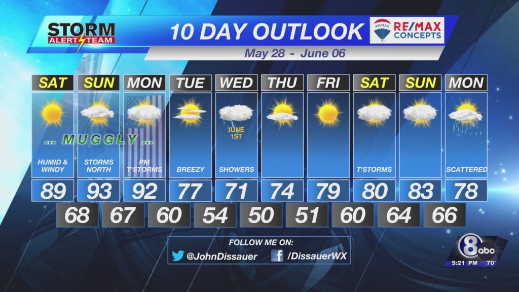
Mainly sunny skies are expected Saturday. Temperatures should be able to climb to the upper 80s to lower 90s. Dew point temperatures should climb to the middle 60s, which will create a heat index 2 to 3 degrees warmer than the air temperature.
Sunday brings additional cloud cover, but even so, temperatures should be warmer. Most should reach the lower 90s by late afternoon.
Dew point temperatures are forecast to be a few degrees higher, so it is going to feel “muggly.” The heat index should top out in the upper 90s.
There will be a chance for a few thunderstorms Sunday evening. I think the best chance will be north of Lincoln, mainly confined to northern Nebraska. If thunderstorms flare up, a few of them could be strong to severe.
A cold front is projected to move into the region Monday night. Ahead of the front, temperatures will again climb into the lower 90s.
By evening, showers and thunderstorms will be possible, some of which could be strong to severe as a line moves through the region.
Be sure to check back through the weekend for updates to the timing of thunderstorms.
Have a fun, and safe, Memorial Day weekend!
– Chief Meteorologist John Dissauer


