Warm Thursday ahead of cold front bringing rain
Temperatures have been warming each day this week and the trend will continue today. This will be the warmest day of the work week.
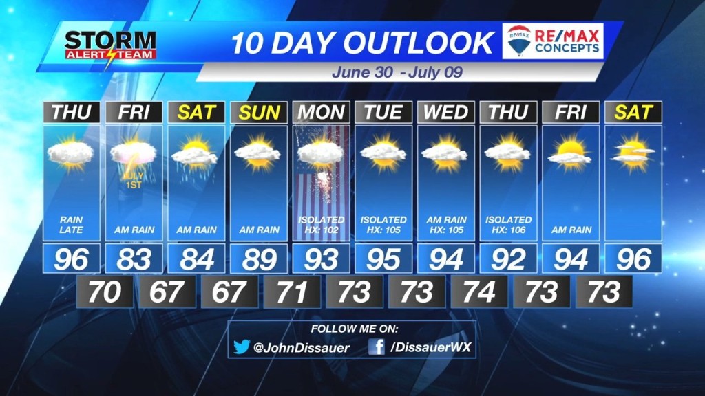
Monday topped out at 83°. Tuesday hit 90°. Wednesday reached 95°. Thursday will see temperatures reaching the middle to upper 90°s, even with mostly cloudy skies overhead. Factor in the humidity – dew points will be in the upper 50°s to lower 60°s – will send the heat index in to the upper 90°s.

A cold front entered western Nebraska Thursday morning. The front will slowly move east across the state, eventually exiting the state early Friday morning. Ahead of the front, showers and thunderstorms will develop.
Most of southeast Nebraska should remain dry through the day. Rain chances increase after 6 p.m. for the Tri-cities. Rain should reach Lincoln by 9 p.m. Thursday night. Showers and thunderstorms will continue through the overnight in to Friday morning. The rain should taper off by late Friday morning.
Behind the cold front temperatures will be significantly cooler. Temperatures will only be in the lower 80°s Friday afternoon.
– Chief Meteorologist John Dissauer


