Record Warmth & Extreme Fire Weather
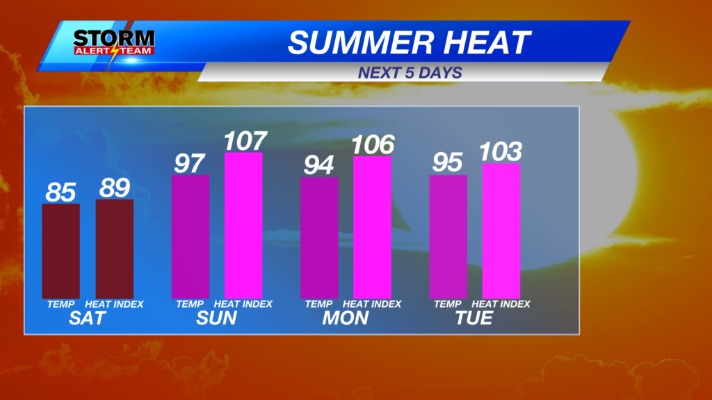
If you enjoyed Sunday, today will be similar! High temperatures reaching the 60s & 70s with NW winds 5-10 mph under sunny skies! RECORD: 72° set back in 2017.

SW->NW winds will gust to near 15 mph through your Monday. This all changes Tuesday…

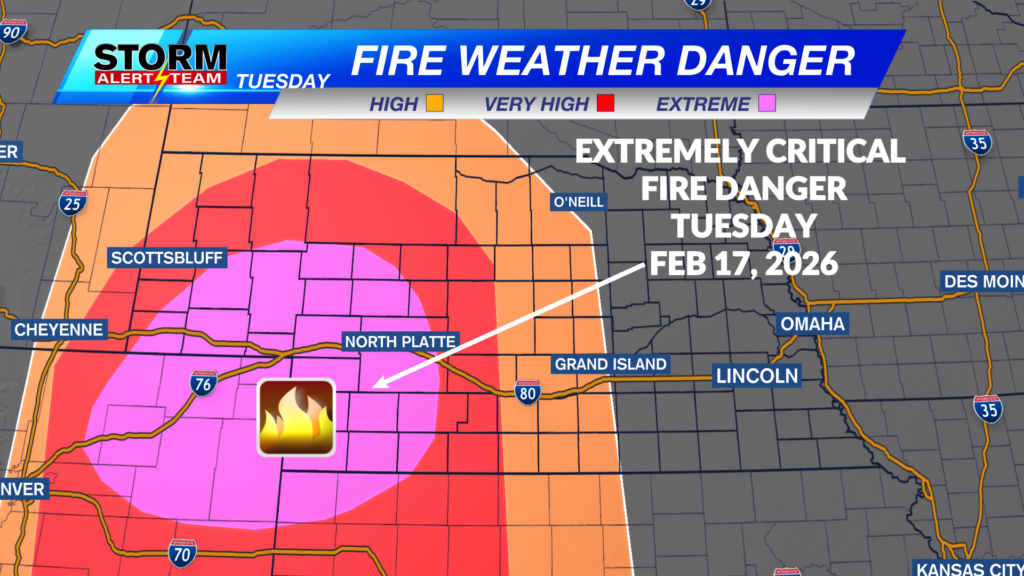
A PDS (Particularly Dangerous Situation)RED FLAG WARNING is in effect noon- 8pm Tuesday. The main concern near and west of HWY 61. Record warmth, dry vegetation, strong W winds 40-55 mph & RH <15% will fuel HIGH fire conditions.

FIRE WEATHER WATCHES are in effect noon- 8pm Tuesday across eastern Nebraska. Any fires that develop Tuesday will have the potential to spread quickly off towards the east.

SW Nebraska, the sandhills and areas near or west of HWY 61 are in a rare EXTREMELY CRITICAL fire danger outlook Tuesday.

CRITICAL fire weather conditions Tuesday. Very dry, windy & WARM conditions will fuel fire conditions. Temperatures reaching the 70s & 80s with SW winds 30-45 mph & RH values less than 30%. This will also carry into Wednesday across eastern Nebraska.

Tuesday afternoon, gusty west winds up to 45-55+ mph will take over Nebraska. The strongest winds farther west in the extremely critical area.


A very pleasant Monday across Nebraska. Tuesday turns windy with record warmth. Some light rain and dry lightning Tuesday evening in eastern Nebraska. A cold front moves in Wednesday night, bringing rain/snow mix to the state. Best chance for snow will be north of I-80. Next week brings warmer air and more chances for precipitation.

Meteorologist Houston Hall
Facebook: HHallWX
YouTube: HHallWX