Rain & Storms Friday Afternoon
Expect rain/T-storms through noon across Lincoln. If you are planning to head out to any sporting events this evening, expect some lightning delays! Isolated storms will peak near 3-7pm across Lincoln & Omaha. Some storms could carry dime to quarter size hail with some gusts up to 50-60 mph.

2:30-4pm: Isolated storms will occur near Crete ->Columbus. Pea to quarter size hail & gusty winds could occur.

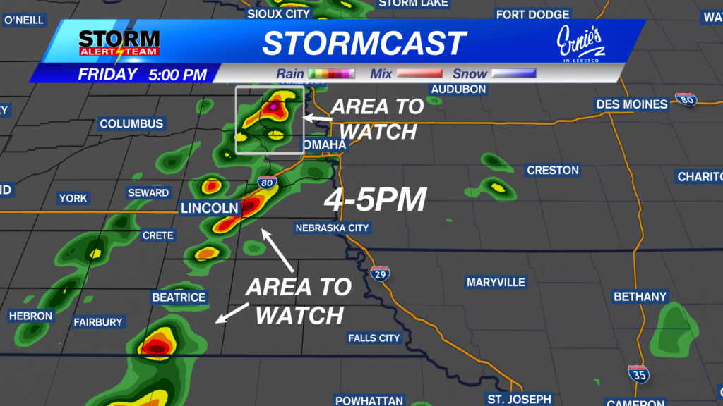
4-5PM: Storms will try to intensify near LINCOLN, Beatrice & Omaha. Quarter size hail, gusty winds & lightning will occur.

5-7pm: Isolated storms continue from E Lincoln->Pawnee City. The strongest storms look to be near Beatrice-> N & S of Omaha. By 9pm, storms should be out of Nebraska!

High temperatures will vary Friday afternoon due to rainfall. Much of the state reaching the 60s and 70s. AVERAGE: 77 degrees.

Rain accumulations up to 0.50″- 0.75″+ across eastern Nebraska through Saturday.

Sunday: May 24, 2026
Sunday evening brings another chance for severe weather. Sunday will be warm & DRY through the day. Isolated storms will try and develop near 4pm Sunday. HAZARDS: Half dollar size hail or greater & gusty winds up to 50+ mph.

3-5pm Sunday:Isolated storms will try & develop along some clouds from O’Neil->Kearney . Hail & gusty winds will be the main concerns.

Rain/storm chances through Friday evening. A warm and beautiful Saturday. Sunday will heat up with isolated storms by the late evening. Memorial Day looks PERFECT for any outdoor activities.Mid week rain/storm chances cool us down to end May!

Meteorologist Houston Hall
Facebook: HHallWX
YouTube: HHallWX


