Hot & Humid With Daily Storm Chances
A HOT & sunny day across eastern Nebraska. Highs ranging from 70° from the panhandle to 94° near Omaha. Eastern Nebraska will see mostly sunny skies with winds between 5-10 mph. Strong to severe storms develop across SW Nebraska near 5-7pm, carrying a LARGE HAIL/WIND threat. Storms form a line as they push east overnight.

High temperatures will vary by near 20 degrees due to rain/clouds farther west! Much of the state reaching the 80s & low 90’s. AVERAGE: 81 degrees.

SEVERE STORMS MONDAY:
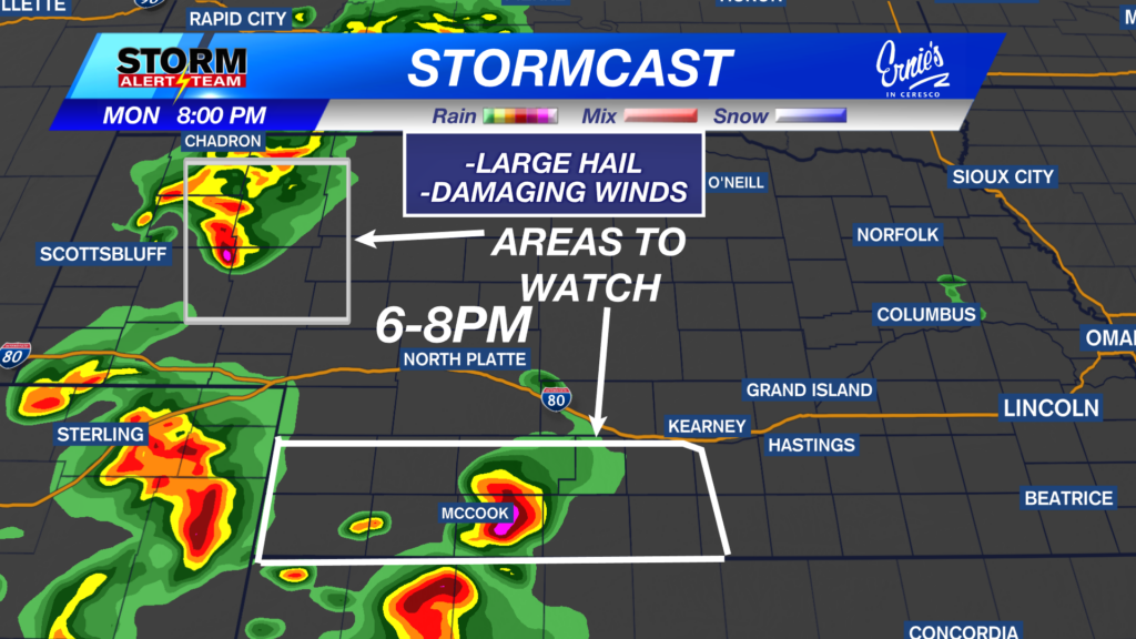
6-8PM: Strong to severe storms develop across SW Nebraska near 6-8pm, carrying a LARGE HAIL/WIND threat.

Damaging wind potential from 8-10pm:

9-11PM: Storms form a line as they move east. Gusty winds & small hail will be the main concerns. Watching areas near Broken Bow & south of I-80 for strong winds.

Damaging wind potential from 10pm-midnight:

Here’s a look at the storm timing and location Monday through Tuesday night:
Rain accumulations up to 0.50″- 1.25″+ across Nebraska through Tuesday night. If you find yourself under a T-storm, expect locally higher amounts.

Severe weather develops out west Tuesday evening. Hail and strong winds will be the main concerns.

Severe weather develops again out west Wednesday evening. Hail and strong winds will be the main concerns.

A warm, muggy and rainy 10 day forecast! Expect daily evening rain/storm chances with the BEST rain chance Thursday across eastern Nebraska. Highs will stay near 82-88 degrees with overnight lows near 60-65 degrees. BENEFICIAL rainfall through this week across the state, as storms start out west and move east through the night.

Meteorologist Houston Hall
Facebook: HHallWX
YouTube: HHallWX


