Cooler Tuesday With Isolated Storm Chances
Lingering rain/storms will continue through this morning across eastern Nebraska. A few isolated storms could form along a boundary from an O’Neil to Hebron line near 2-4pm. IF storms form, some could have small hail/ gusty winds & heavy rainfall. There is NO SEVERE threat highlighted for eastern, NE today. Temperatures will be cooler thanks to the rainfall!

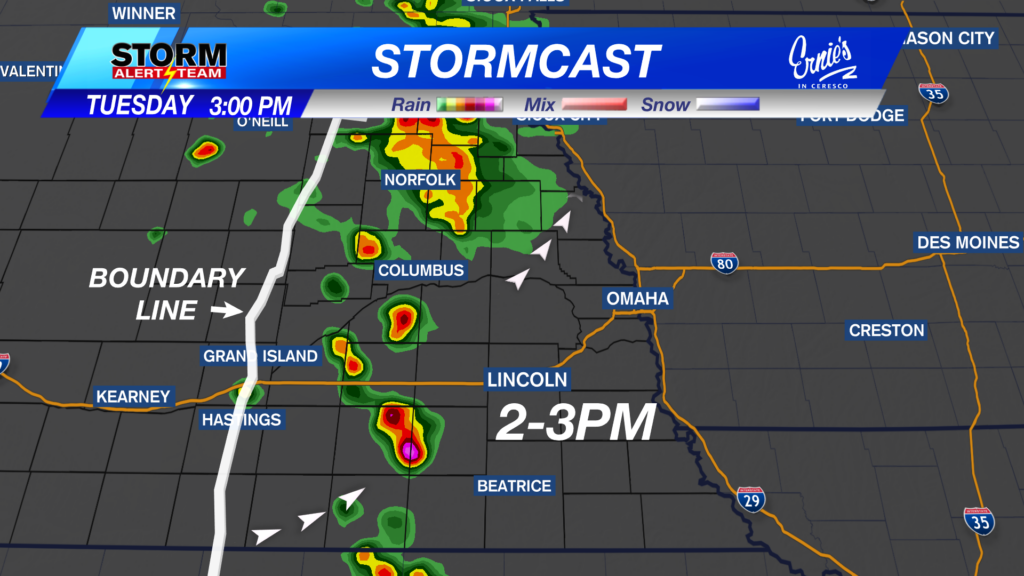
2-3PM: A few isolated storms could form along a boundary from an O’Neil to Hebron line. IF storms form, some could have small hail/ gusty winds & heavy rainfall. There is NO SEVERE threat highlighted for eastern, NE today.

3-4PM: The storms that develop will try & pulse up during this time. Storm fuel will be greater farther west later this afternoon. Storms will weaken by 5-7pm.

Rainfall potential through Tuesday night stays confined along that boundary. Rain accumulations up to 0.50″+ for anyone under those T-storms.

Tuesday afternoon will be much cooler due to cloudy skies and morning rainfall!

Wednesday: June 3, 2026
A few showers & T-storms possible Wednesday morning across SE Nebraska.

Severe weather develops out west Wednesday evening, before moving SE into Thursday morning. Large hail and DAMAGING winds will be the main concerns.

Wednesday night brings storms from SW->NE Nebraska, carrying a large hail & damaging wind threat.

Thursday: June 4, 2026
Severe weather develops again out west Thursday evening, before moving SE into Friday morning. Hail and strong winds will be the main concerns.

A warm, muggy and rainy 10 day forecast! Expect daily AM/PM rain/storm chances with the BEST rain chance Thursday across eastern Nebraska. Highs will stay near 82-92 degrees with overnight lows near 60-65 degrees. BENEFICIAL rainfall through this week across the state, as storms start out west and move east through the night.

Meteorologist Houston Hall
Facebook: HHallWX
YouTube: HHallWX


