Friday Evening Severe Weather Update – June 5, 2026
Latest update: 6:58 p.m. CDT, Friday, June 5.

A Severe Thunderstorm Watch has been issued for south-central and southeastern Nebraska until 12 a.m. CDT on Saturday, June 5. Now is the time to review your severe weather plan, whether you are heading out or staying in this evening.

Scattered severe storms remain possible on Friday evening and into the overnight hours. A Slight Risk (Level 2 out of 5) of severe weather is in place for south-central and southeast Nebraska, including the city of Lincoln.
- For up-to-the-minute radar: CLICK HERE.
- For the latest warnings: CLICK HERE.
- For a live look at our Nebraska Weather Cams: CLICK HERE.
- And we would love to see video of any storm footage you may get (safely!). You can upload that using our Now Local News App: CLICK HERE.
An isolated tornado, up to golf ball-sized hail, and 60 mph wind gusts will be possible in the strongest storms.
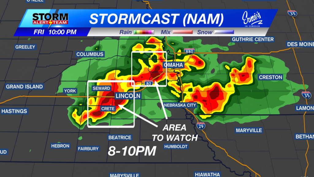
Here is a look at one of the runs of StormCast, giving you an idea of when storms could reach your area.

In addition to the previously mentioned hazards, flash flooding will be possible for areas that saw significant rainfall on Thursday as more precipitation moves through the region. A Flood Watch is in place until 7 a.m. CDT on Saturday, June 6.
Storm Alert Team Meteorologist
Dominic Ferraro
X: DomFerraroWX
Facebook: DomFerraroWX
YouTube: DomFerraroWX