Cooler & Windy Thursday
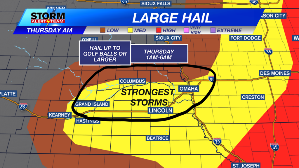
Some heavy rainfall from Thursdays severe weather across eastern, NE. FLASH FLOOD WARNING have been issued due to a band of 4-6″ of rainfall from Lincoln and west. Turn around and don’t drown if you come across high water.

A much COOLER, sunny & drier day across the state! High temperatures only reaching the 70s & 80s under sunny skies. NW winds will be gusty across the state, with gusts up to 35-45 mph.

NW winds will pick up as we go into Thursday afternoon. This is due to the storm system moving east, giving us the backside windy conditions!

Severe storms are possible Saturday evening from Omaha and areas in far SE Nebraska. Hail, winds and isolated tornadoes all threats.

Friday looks very pleasant, breezy and dry. Rain/storm chances Saturday evening from Omaha & south, with a nice cool start to the week, before HOT & humid again!

Meteorologist Houston Hall
Facebook: HHallWX
YouTube: HHallWX