Severe weather possible: July 1-2, 2026


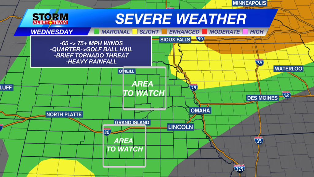
Parts of Nebraska may see large hail this evening and overnight. Not everybody will see the large hail, but the storms that can get strong to severe will have hail in them. The area in the brown shaded area may see hail up to 1.5” in diameter. The area shaded in yellow may see hail up to 2″ in diameter.

There’s a small risk for tornadoes for much of the state, but the better chance is further northeast.

Not everybody will see very strong winds, but the storms that can get severe will see very gusty winds. The area in the brown shaded area may see wind up to 65 mph. The area shaded in yellow may see wind between 65 and 70 mph.
Above is what our StormCast weather model is saying for timing, duration, and location of the storms.

Strong to severe storms are going to once again be possible on Thursday, especially in north central and northeast Nebraska. Timing for this storm chance will be in the late afternoon into the nighttime hours.

It’ll be warm on Thursday, but not too far from normal. It will be a little humid, though.

The humidity will tack on a few degrees onto the “Feels Like” temperatures. We’ll be very close to 100 in eastern Nebraska.

Warm with storm chances in Lincoln Friday, Saturday, into Sunday. It won’t be storming the entire time and not everybody will see rain, but the chance is there each day.

We have another chance for strong to severe storms Friday night, especially further north.

Chief Meteorologist Rusty Dawkins
Facebook: RustyWx
YouTube: RustyWx
TikTok: RustyWx
BlueSky: RustyWx
Instagram: RustyWx
Threads: RustyWx
Twitter: RustyWx