A Cooler Next Few Days
High temperatures Thursday will be near or BELOW AVERAGE under mostly/partly sunny skies! Friday brings the same story, if not a few degrees cooler.

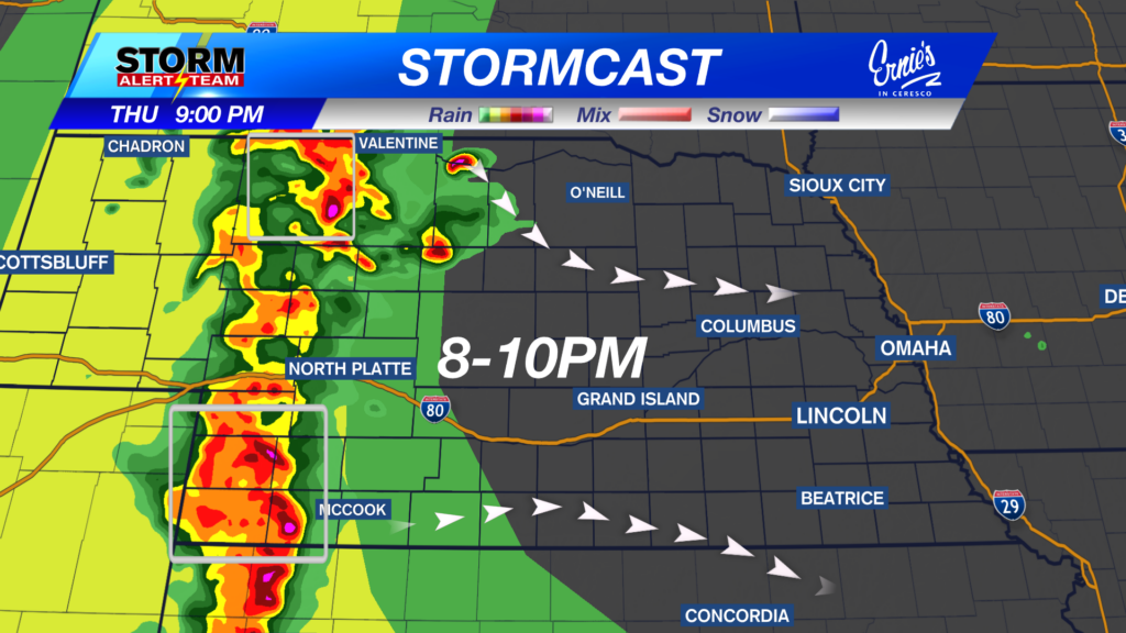
8-10pm: A line of storms will develop out west, with a ESE motion. Storms could have 60+ mph winds, half dollar HAIL & heavy rainfall.

1-4am FRIDAY: Storms will weaken/collapse around Broken Bow & Grand Island, meaning gusty outflow winds up to 45-55 mph+ & small hail.

7-11am FRIDAY: SE Nebraska could see some isolated showers/T-storms through lunch time Friday. After that, the HOT & DRY forecast begins!!

Rainfall potential through Friday morning: Best chance for 1-2″+ of rain will be across SW Nebraska & areas south of I-80.

Thursday & Friday brings cooler temperatures with our last chances of rain until next Sunday. This weekend starts our HOT and DRY stretch! The middle to end of next week, temperatures could reach the triple digits across the state. It has been 384 days since Lincoln has seen 100 degrees!

Meteorologist Houston Hall
Facebook: HHallWX
YouTube: HHallWX


