SEVERE Storms Monday & Tuesday
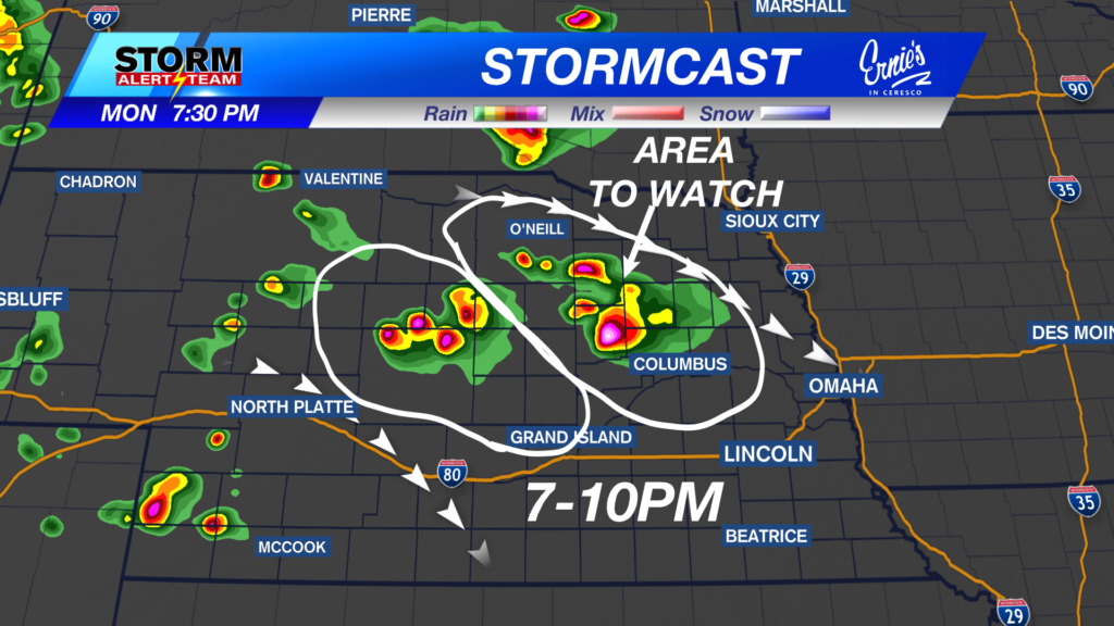

Strong storms capable of 65-75+ mph winds, golf ball sized hail, a few brief spin ups & flooding will move NW->ESE this evening into early Tuesday morning.
For up to the minute radar, go HERE.
For the latest warnings, go HERE.
For a live look at our Nebraska Weather Cams, go HERE.
And we would love to see video of any storm footage you may get (safely!). You can upload that using our Now Local News App HERE.
A few brief spin ups will be possible with any discrete storms this evening. *6pm-11pm*


Wind up to 65-75 mph will be possible as storms turn linear later tonight.


Large hail up to golf balls will be likely within the first initial storms.

EARLY Tuesday Severe Weather: August 18, 2026

5-7am: Storms will spread across SE Nebraska, carrying heavy rain, small hail and gusty winds.

8-11am: Storms will continue from Omaha and south.

Rainfall potential through Tuesday evening is looking nice but concerning! Flooding will be a concern as some spots could see up to 2-4″ of rain, especially where areas have already seen several inches of rain last week.


Meteorologist Houston Hall
Facebook: HHallWX
YouTube: HHallWX