Very WINDY Friday Before Rain Saturday
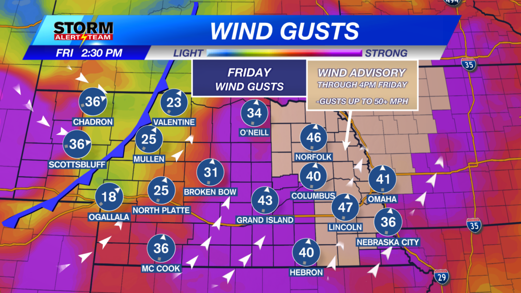
A WINDY & WARM day under mostly/partly sunny skies across Nebraska. High temperatures statewide ranging from 57° – 73° with dew points in the 20-> 50s!


Saturday: (noon-4pm): Light rain develops across SE Nebraska with light drizzle farther west.

Saturday: (5-9pm): Heavier rain starts to fall with a few T-storms S/SE of Lincoln. The SEVERE threat lays farther south into Kansas.

Rainfall potential through Saturday night will favor far SE Nebraska due to T-storms. Most of us will likely see 0.25″-0.5″+.

HUSKERCAST Saturday: Have a jacket handy & even a rain poncho. Temperatures start in the upper 50s & drop every hour. Light rain/drizzle could occur through the game with gusty winds making it feel COLD.

High temperatures look to stay near 43° – 56° through the next 10 days! *Morning temperatures look to cool near 17° – 32°! The BEST rain chance comes Saturday afternoon/evening. A small chance for a few flurries Tuesday into Wednesday. Late next week for Thanksgiving & beyond, a few precipitation chances could be around. Stay tuned for the latest.


