Update: Blizzard warning issued Saturday
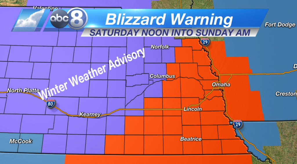
A blizzard warning has been issued for Monona, Harrison, Shelby, Pottawattamie, Mills, Montgomery, Fremont, Page, Thurston, Cuming, Burt, Colfax, Dodge, Washington, Butler, Saunders, Douglas, Sarpy, Seward, Lancaster, Cass, Otoe, Saline, Jefferson, Gage, Johnson, Nemaha, Pawnee, and Richardson Counties.
A winter weather advisory will be in effect until noon Saturday.
A blizzard warning in effect from noon Saturday to 3 a.m. Sunday.
A winter weather advisory remains in effect until noon Saturday.
Expect mixed precipitation through Saturday morning. Blizzard conditions are expected Saturday afternoon into Saturday night. A total snow accumulation of 6 to 12 inches is possible throughout our area according to Channel 8’s Chief Meteorologist Dean Wysocki. There could be wind gusts of up to 35 to 50 mph expected Saturday afternoon into Saturday night.
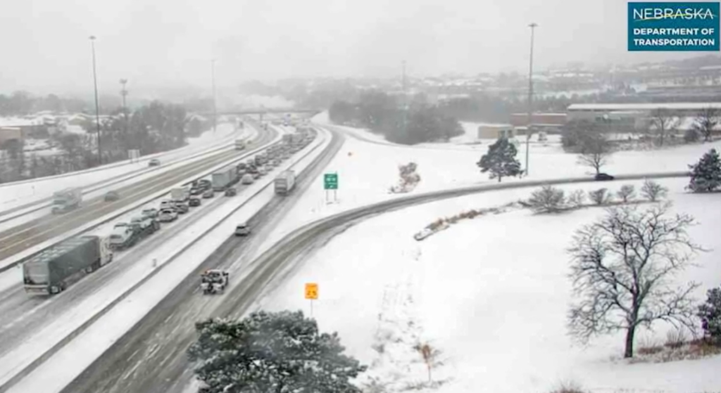
Drivers should plan on roads becoming very hazardous or impassable Saturday afternoon and evening. Areas of blowing snow could significantly reduce visibility. Gusty winds may bring down tree branches and cause power outages.
A blizzard warning means severe winter weather conditions are expected or occurring. Falling and blowing snow with strong winds and poor visibilities are likely. This could lead to whiteout conditions, making travel extremely dangerous.
A winter weather advisory means that periods of snow, sleet or freezing rain will cause travel difficulties. Expect slippery roads, limited visibilities, and use caution while driving.
The latest road conditions for the state can be obtained by calling 5 1 1 or visiting their website.