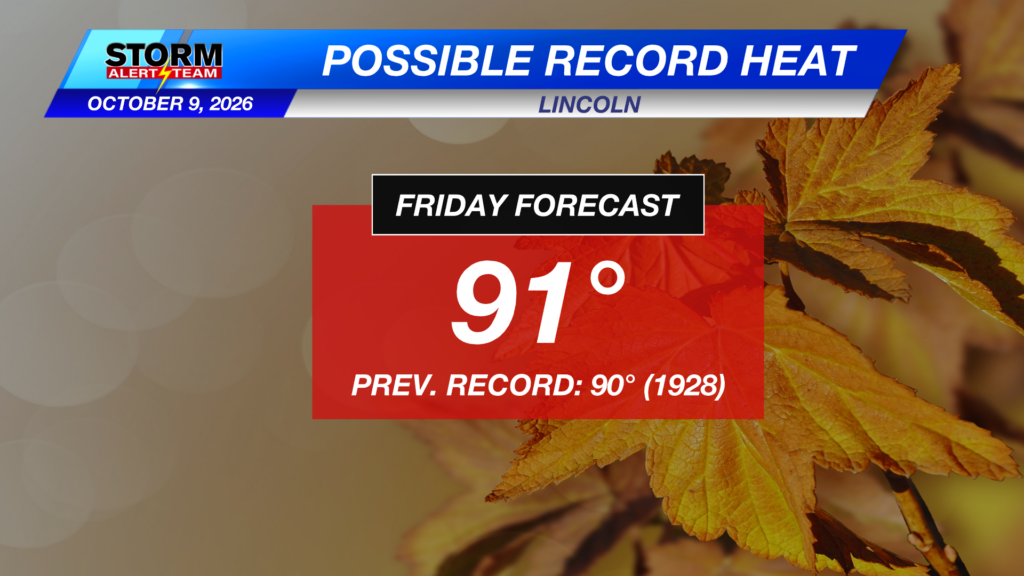
Heat Continues Before Fall Returns Tuesday
Sunday morning will be well ABOVE AVERAGE & WINDY! Temperatures waking up will be in the 50s & 60s across the state under clear skies. South winds will be ramping up across SE Nebraska.

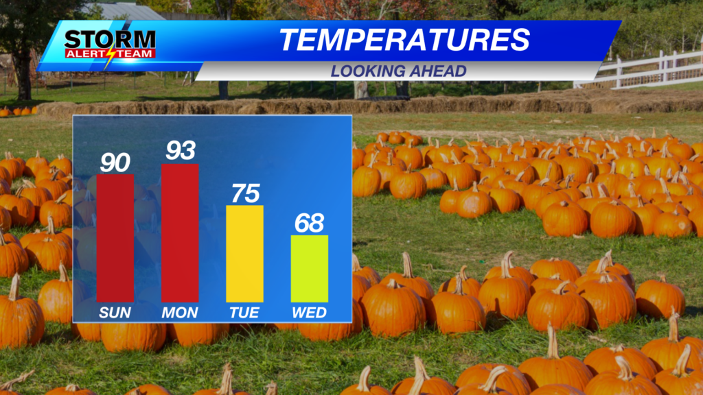
Sunday afternoon, high temperatures ranging from 77° – 93° with dew points in the 40s & 50s! Cooler temperature farther west as our cold front SLOWLY approaches!

South winds will gust up to 20–25+ mph across SE Nebraska through Sunday afternoon. Winds will slowly relax past Tuesday.

A quick heat spike Monday ahead of the cold front across SE Nebraska. Tuesday starts our temperature drop to the 70s & then 60s/50s by Friday!

Our next BIG CHANGE & rain/storm chances come Wednesday-Thursday. Some SEVERE weather could occur across SE Nebraska as this system moves in Wednesday evening.

High temperatures look to stay near 57° – 93° through the next 10 days! *Morning temperatures look to stay near 33° – 51°! Expect WINDY conditions through Tuesday. Some NEAR FREEZING temperatures late next week as a potent system moves through. Rain/storm & SEVERE weather chances increase Wednesday- Thursday. Stay tuned for the latest.

Meteorologist Houston Hall
Facebook: HHallWX
YouTube: HHallWX