Hot & Muggy With Storm Chances
A warm/ muggy day, with storms W->E tonight. Rain could occur near 6-8pm near Lincoln. Highs reaching the 80s across the state under partly sunny skies.


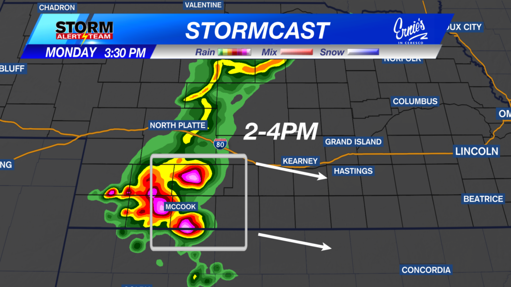
2-4PM: Storms INTENSIFY & track ESE, carrying a DAMAGING wind/hail threat across SW Nebraska & areas like Oxford, Alma & Arapahoe.

4-6PM: Storms become a DAMAGING WIND threat as they move along the NE/KS border. Another line of storms farther west will carry a damaging wind threat as it weakens into the overnight. Eastern, NE could see storms near 3-5am Tuesday.

Damaging winds up to 70-75+ mph will be the main concern with these storms Monday evening & night.

Flooding could be a concern through tonight as rain accumulations up to 2.5″+ will be possible

Tuesday Severe Weather

Tuesday, June 9, 2026
Eastern Nebraska will need to keep an eye out for Tuesday evening and night, due to uncertainty on storm placement. Tuesday morning storms will determine what happens by the evening hours.

VERY HOT & MUGGY Tuesday! Feel like temperatures in the triple digits across much of eastern & SE Nebraska.

Hot, muggy and rainy through this week. Storm chances this weekend with a big cool down next week!

Meteorologist Houston Hall
Facebook: HHallWX
YouTube: HHallWX


