Isolated Storms Before Hot Thursday
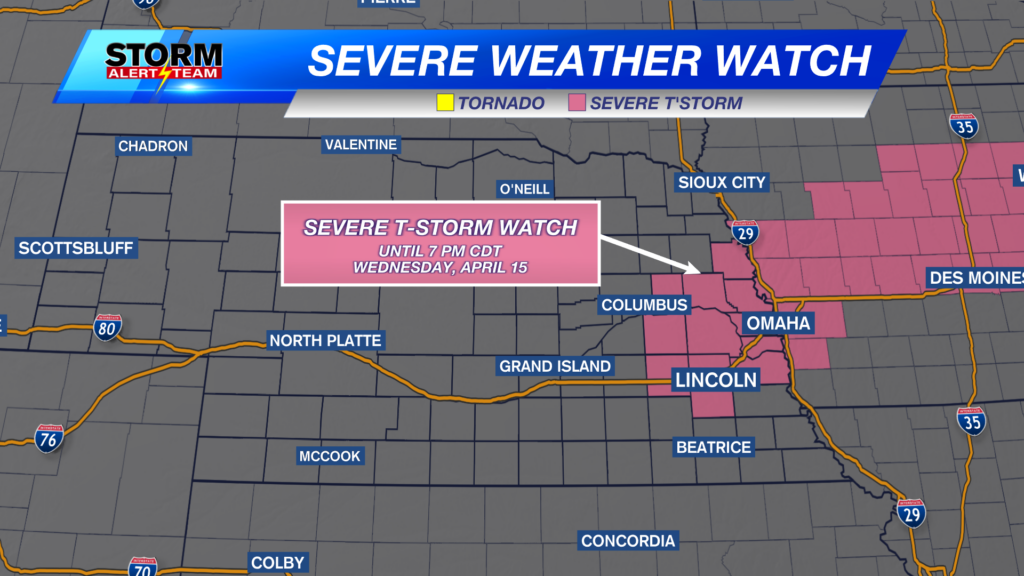
A SEVERE THUNDERSTORM WATCH is in effect until 7pm Wednesday evening. This includes Lincoln & Omaha. Isolated strong to severe storms will be possible along an unstable boundary along and north of I-80 through this evening.

noon-3pm, isolated to sporadic showers and T-storms will move ENE from the Tri- cities. Some storms could carry quarter size hail, making for a marginal severe threat.

A MARGINAL risk is in place through this afternoon. Main concern is quarter to half dollar size hail & 60+ mph gusts.


SE Nebraska, keep an eye out for Friday afternoon and evening! A strong cold front will push through bringing a good chance for strong to severe storms with all hazards possible. Right now, models trend farther east for storms. Strong winds will be a concern Friday afternoon and evening as the front move in.

A hot and sunny Thursday. SE Nebraska, keep an eye out for Friday afternoon and evening! A strong cold front will push through bringing a decent chance for strong to severe storms with all hazards possible. A beautiful weekend with cooler temperatures and less humidity!

Meteorologist Houston Hall


