Last HOT Day Before Storms Tonight
One last HOT HOT day across SE Nebraska!! Peak heat index values from 99° – 108°. Relief comes Wednesday morning/afternoon.

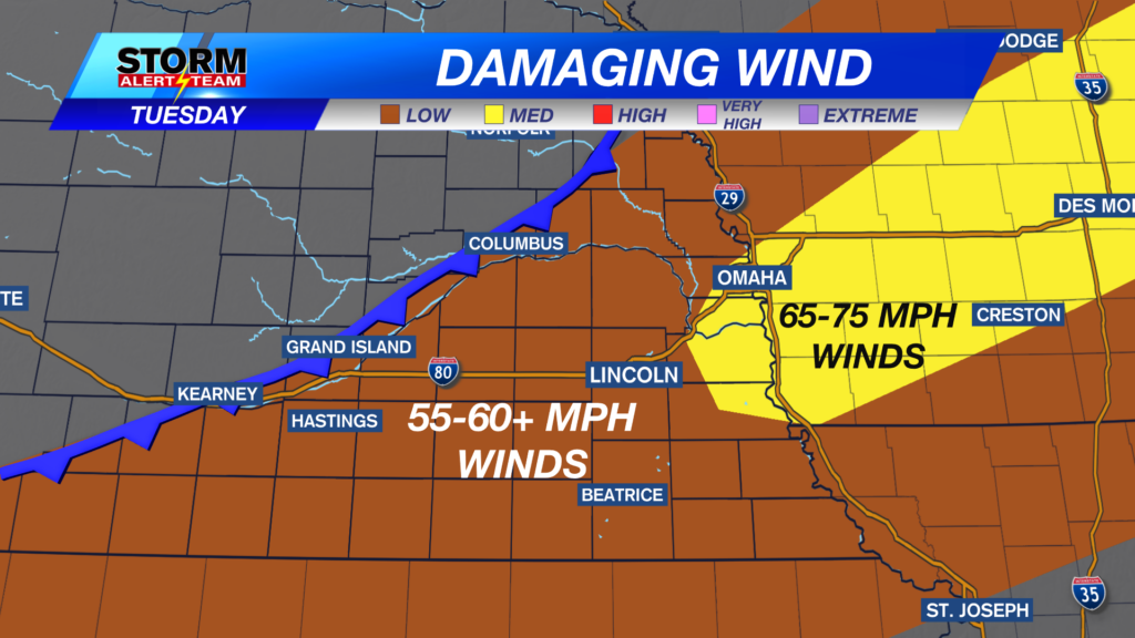
This evening, a few strong to severe storms capable of 60+ mph winds, small hail & heavy rainfall will occur across SE Nebraska. This is all ahead of our long awaited cold front & new refreshing air. Rain will linger into Wednesday morning. TIMING: 4pm Tuesday- 7am Wednesday.


7-10pm: A few storms could INTENSIFY during this time. Storms become linear from Omaha & south, carrying gusty winds & small hail.

Midnight-5am WEDNESDAY: Showers & T-storms will linger across SE Nebraska due to the cold front stalling. A few stronger storms could be possible Wednesday morning.

Rainfall potential through Wednesday will be highest from Columbus & southward. Some spots may receive 1.5″ or more. Average rain for most will be near 0.50″-1.0″.

Severe Weather Friday-Saturday: September 11-12, 2026

Storms in SE Nebraska Tuesday evening through Wednesday morning. A BEAUTIFUL Wednesday & Thursday afternoon, before a quick warm up Friday. A bigger cold front Friday night which should bring nice weather to the next Huskers football game. More fall like weather hopefully stays around next week.

Meteorologist Houston Hall