Rain & Storm Chances On The Rise
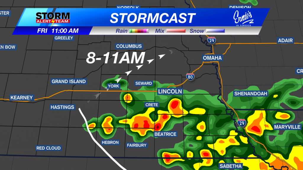
FRIDAY MORNING (8am-11am): Rain & T-storms re-develop in SE Nebraska. Best rain chances from Hasting & east. South of I-80 will see the bulk of the rain.

Friday night will bring isolated T-storms across E Nebraska, from Hastings & northward. Light rain/drizzle farther west.

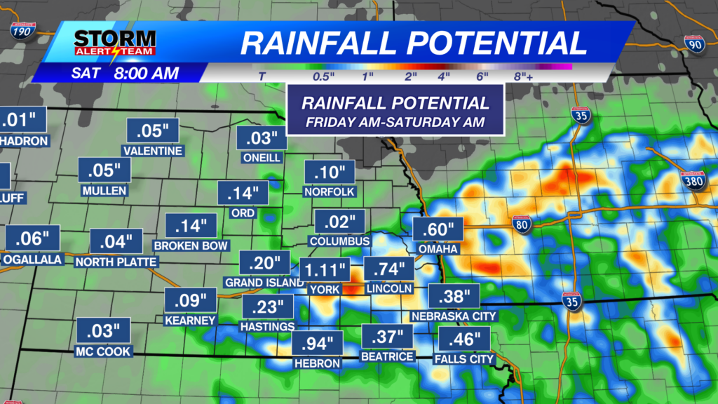
Rainfall through Saturday morning: SE Nebraska could see 0.5″-1.0″+ Friday-Saturday morning. Farther west will see lighter rain/drizzle.

Husker game or Trick or Treating? Expect cool temperatures with light rain through midnight.

NEXT MONDAY-TUESDAY: Expect heavy rain & T-storms all day Monday, with lighter rain all day Tuesday.

Rainfall through Tuesday night looks decent across the state! Rain totals from 1.5″ out west to 3-4″+ farther east! Keep an eye on the forecast through this weekend.

High temperatures look to stay near 57° – 68° through the next 10 days! *Morning temperatures look to cool near 33° – 50°! The BEST RAIN CHANCE arrives Monday & Tuesday. Much cooler air settles in late next week after the storm systems move out!

Meteorologist Houston Hall
Facebook: HHallWX
YouTube: HHallWX