Severe Storms Wednesday Afternoon

A Severe Thunderstorm Watch is in place for central and eastern Nebraska until 4 p.m.CDT on Wednesday, August 19.
- For up-to-the-minute radar: CLICK HERE.
- For the latest warnings: CLICK HERE.
- For a live look at our Nebraska Weather Cams: CLICK HERE.
- And we would love to see video of any storm footage you may get (safely!). You can upload that using our Now Local News App: CLICK HERE.
9-11AM: Storms will move through NE Nebraska, carrying a hail, damaging wind & heavy rain threat. *Storms will have a SSE motion*

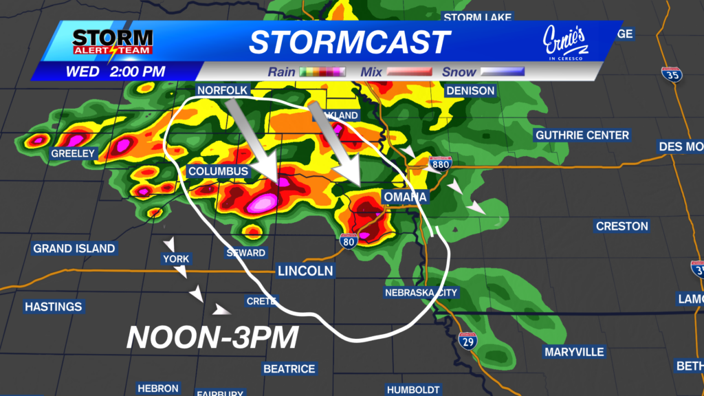
9-11am: Storms will move through NE Nebraska, carrying a hail, damaging wind & heavy rain threat. *Storms will have a SSE motion*

NOON-3pm: Storms will be in & around the Lincoln, York & Seward area, carrying gusty winds, hail, brief spin up & heavy rain.

A brief spin up or two can’t be rule out due to the discrete nature of storms.


Thursday evening brings an isolated severe weather chance from NE->SW. Some gusty winds & hail will be the main threats.

Watching Friday evening into early Saturday close! Strong to severe storms capable of all hazards will move NW->SE. More to come as we get closer!

Daily morning and night time rain/storm chances through Saturday. Temperatures try and warm up to end the week, before a quick cool down this weekend. Next weekend looks average with minimal rain.

Meteorologist Houston Hall
Facebook: HHallWX
YouTube: HHallWX