Warm & Breezy With Late Storm Chances


Large hail will be the main concern with any storms tonight in SE Nebraska. The main timing will be from 9pm-1am Wednesday morning.

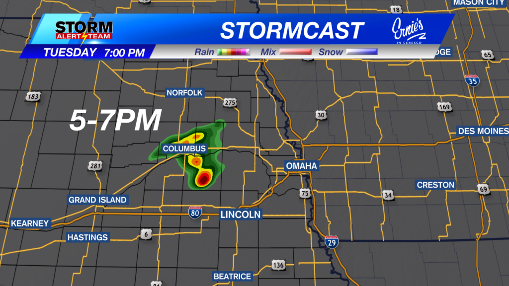
4-7PM this evening, an isolated storm or two could develop as it tracks NE towards Omaha near 7pm. Quarter size hail and 60 mph gusts will be the threat.

The main threat for severe weather will be from 9pm-2am Wednesday morning. Isolated storms could produce small to large hail along a moist boundary.

Far SE Nebraska will likely see some lingering T-storms through midnight tonight.


SE Nebraska, keep an eye out for Friday afternoon and evening! A strong cold front will push through bringing a decent chance for strong to severe storms with all hazards possible.

A few strong storms possible Tuesday night from 7pm -midnight across SE Nebraska. Large hail being the concern. A hot and sunny Thursday. SE Nebraska, keep an eye out for Friday afternoon and evening! A strong cold front will push through bringing a decent chance for strong to severe storms with all hazards possible. A beautiful weekend with cooler temperatures and less humidity!

Meteorologist Houston Hall


