Severe Thunderstorm Watch through 11:00pm, June 2, 2024
A SEVERE THUNDERSTORM WATCH is in place for much of the western half of Nebraska through 11:00pm and until midnight for south central Nebraska. Additional watches may be needed further east for the overnight time frame.

For up to the minute radar, go HERE.
For the latest warnings, go HERE.
For a live look at our Nebraska Weather Cams, go HERE.
And we would love to see video of any storm footage you may get (safely!). You can upload that using our Now Local News App HERE.
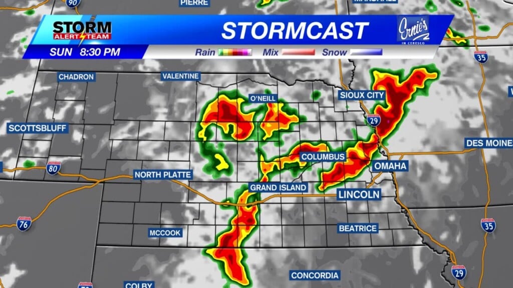
Above is the latest forecast from our StormCast weather model. Strong storms will move from west to east tonight.

Storms will be capable of producing tornadoes. The area shaded in brown (above) will have the best chance.

Very large hail will be possible for much of Nebraska, especially in the red shaded area.

Wind in excess of 75 mph will be possible for much of the state, as well.

As is usually the case with thunderstorms, very heavy rain will be possible, but very hit and miss. 1-3″ of rain will be possible for some that do get under those thunderstorms.

Because of this heavy rain potential, much of the eastern half of Nebraska is in a “Medium” risk for excessive rainfall and flooding.
Chief Meteorologist Rusty Dawkins
Instagram: RustyWx
Facebook: RustyWx
YouTube: RustyWx


