Severe Storms Thursday Afternoon
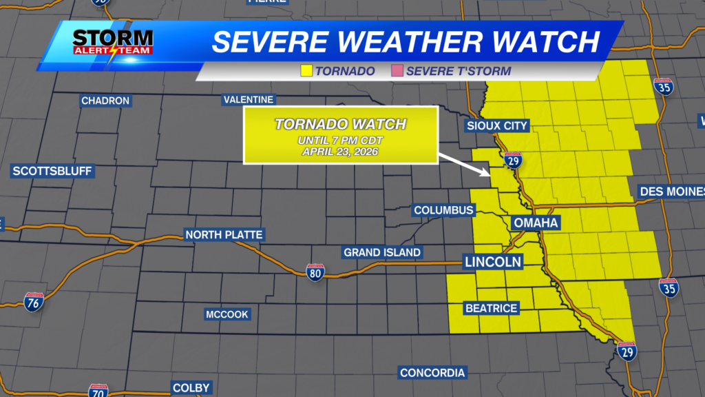
A TORNADO WATCH is in effect through 7PM Thursday. Storms ahead of a cold front will INTENSIFY in the coming hours near 2-3pm. A few isolated tornadoes will be possible east & south of Omaha and Lincoln near 4-6pm. Stay tuned through the afternoon for the latest!

(2-4pm) Isolated storms initiate north of Omaha, along & east of HWY 77 Thursday afternoon. These storms will carry a LARGE HAIL & WIND threat. Storms will quickly INTENSIFY when the CAP is broken by 4-5pm.

Large hail up to golf balls or greater will be a main concern with the first initial storms near 3-4pm.

(5-7pm) The PEAK severe storms will occur from HWY 75->Iowa. This line of storms will carry a LARGE HAIL, DAMAGING WIND & brief Tornado threat. Storms will quickly move W->SE. Updates will be posted through this morning!

A 5% hatched tornado threat is in place Thursday evening. A few brief tornadoes will be possible within the line of storms in SE Nebraska near 5-7pm.

The best chance for widespread showers & T-storms comes Sunday through Monday morning. Some severe weather will be possible across SE & eastern Nebraska.

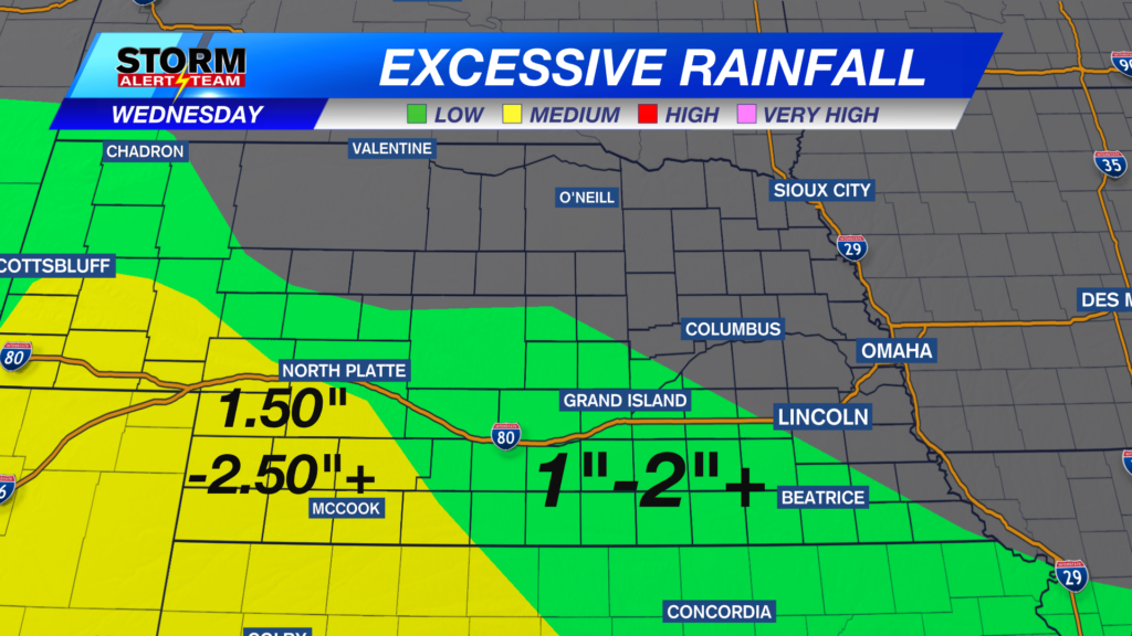
Rainfall potential through Sunday night looks very delightful! Much of the state will be looking at rain totals 0.25″-0.75″+.

Severe storms this afternoon near 2-6pm. Friday will be sunny, cool & breezy. Saturday looks dry for much of the morning, before increasing rain/storm chances Saturday afternoon through all day Sunday. Next week looks cooler than average with small precipitation chances mid to late week.

Meteorologist Houston Hall