Severe Weather Chances Through Friday

Heat index values could exceed 107°+ during the peak afternoon across SE Nebraska.

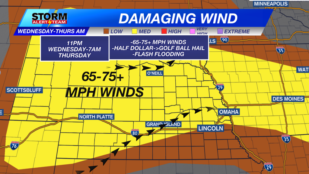
The main severe weather threat develops out west Wednesday evening/night! Winds up to 65-75+ mph, large hail & flash flooding. Storms move ENE overnight into early Thursday morning.


THURSDAY AM *midnight-5am*: Areas north of I-80 across NE Nebraska including near Omaha will need to be watched due to STRONG WINDS capable of 60-70+ mph, hail and heavy rainfall. Watching areas near Ord, Neligh, Norfolk, Plainview & Albion.

4-6am: The strongest of storms will occur in NE Nebraska, with a few showers & thunderstorms near Omaha and Lincoln.

Rainfall potential through Thursday evening is looking nice but concerning! Flooding will be a concern as some spots could see up to 2-4″ of rain, especially where the severe & exceptional drought lays out west.

Thursday morning showers/thunderstorms from I-80 and north. Daily rain and storm chances through the next 7 days. A brief cool down comes Sunday, with temperatures staying in the 80s through next week.

Meteorologist Houston Hall
Facebook: HHallWX
YouTube: HHallWX



