Warm Tuesday Before Late Storms
A warm & humid day across Nebraska under partly sunny skies! High temperatures will range from 82° – 90° with dew points in the 60s & 70s! The evening hours will bring the HUMID feel to areas south of I-80.

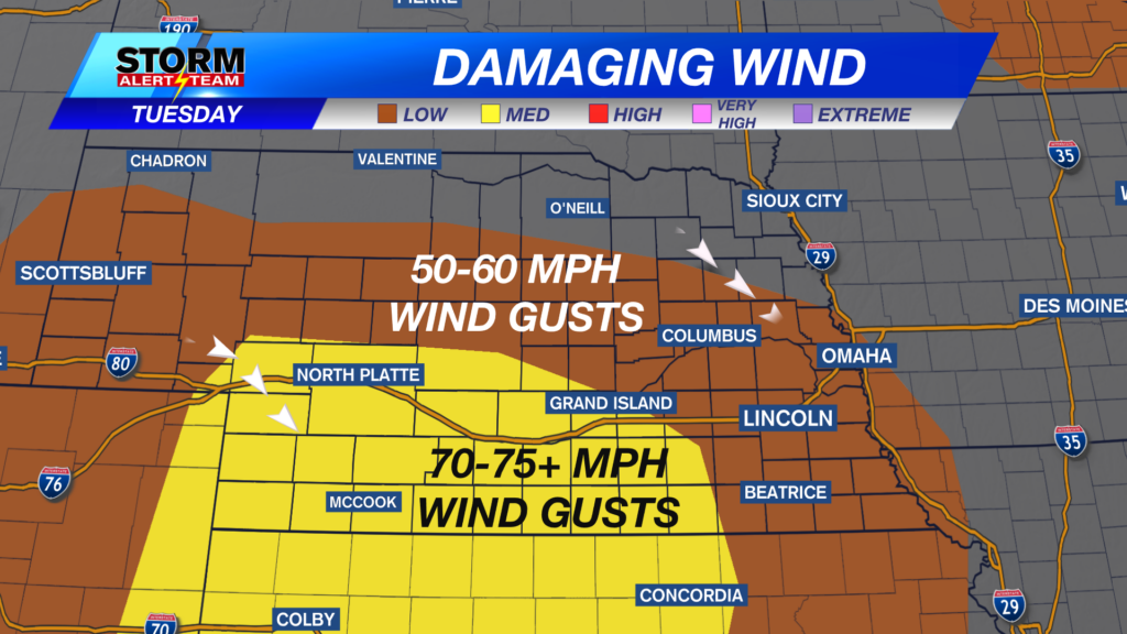
Damaging winds up to 65-75+ mph will be possible with these storms Tuesday evening. Small/large hail could accompany storms also across SW Nebraska. *The bulk of the severe storms will stay west Lincoln. A few storms overnight could have some gusts near 40-45 mph.


SW Nebraska could see hail up to golf balls with the first storms this evening.


Early Wednesday: 2-5am, a few storms could occur along & south of I-80 including Lincoln & Omaha. A few storms could have gusty winds, lightning & heavy rain.


A pleasant mid week with near average temperatures. A quick warm up is in store as we head into this weekend with potential for storms Saturday night. September could bring an active pattern & cooler air.

Meteorologist Houston Hall