Strong Winds, Lows Near Freezing on Friday and Saturday
Weather Headlines:

Our first freeze of the fall season looks to arrive during the next couple of mornings statewide. A Freeze Warning will be in place through Friday morning (October 16) for portions of the panhandle, with air temperatures dropping to the upper 20s. A Freeze Watch will be in effect for the eastern two-thirds of the state on Friday night into Saturday morning, with forecast lows in the lower 30s.

As an area of high pressure moves in from Canada through the end of the week, that will cause an uptick in our winds on Friday. Expect gusts up to 45 miles per hour as we end the work week.
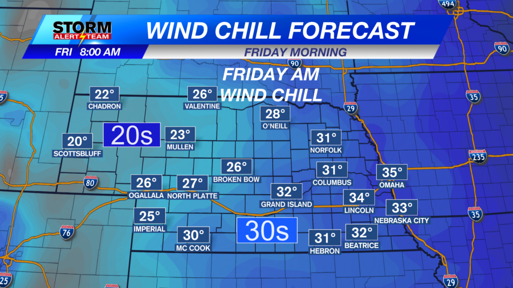
As northerly winds surge, that will also push our wind chills down into the teens for some on Friday morning, as well as the upper 20s in eastern Nebraska on Saturday morning.
Forecast:

Air temperatures tonight will fall to the upper 20s to upper 30s across the state. Cloud cover is expected to briefly clear out, which will allow for a chilly start to our Friday morning.

Winds will pick up in Lincoln through the overnight hours, which will help push our temperatures down to the upper 30s.
Precipitation chances fizzle out through the evening as StormCast shows a quiet end to the week on Friday. Incoming high pressure will help clear out any clouds by Friday evening.

Stronger winds, along with a mix of clouds and sun, will keep things on the cooler side again Friday afternoon. High temperatures are forecast in the lower to middle 50s for most.

We get off to a chilly start in Lincoln before the sun tries to peek out during the afternoon. Strong winds will linger through the afternoon, bringing a chilly fall evening to end the week.

Air temperatures will fall close to freezing on Saturday morning before recovering through the weekend. Highs return to the upper 60s and lower 70s ahead of our next chance at precipitation during the latter half of next week.
Storm Alert Team Meteorologist
Dominic Ferraro
X: DomFerraroWX
Facebook: DomFerraroWX
YouTube: DomFerraroWX