Rain chance Saturday, then cooler air moves in
After a windy Friday, the wind dies down a little bit for the weekend. Cooler air is headed our way along with some showers and t-storms.

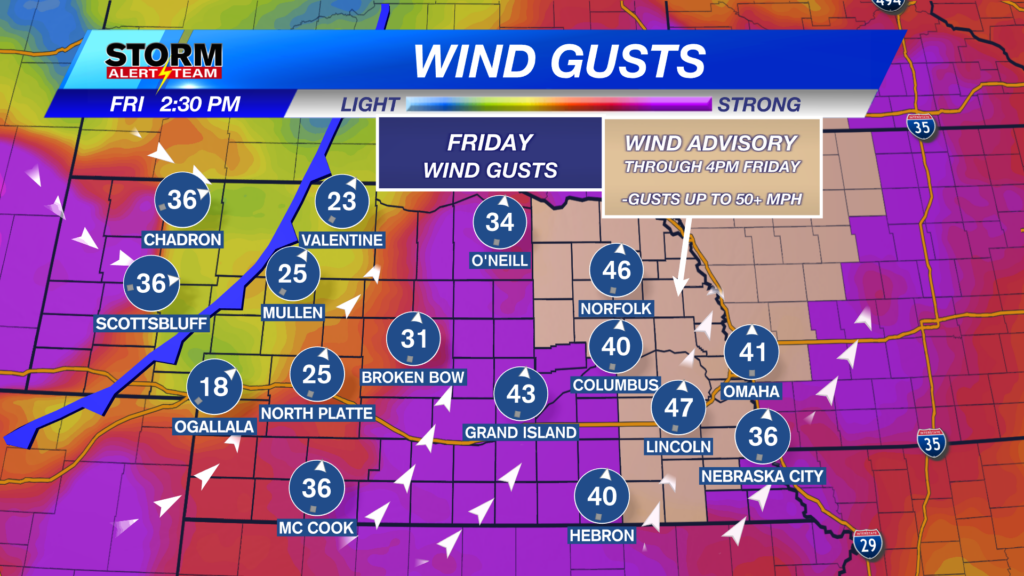
Wind gusts Friday got very close to 50 mph in eastern Nebraska. Most of us were in the 30-40 mph range.

After a cold front moves through Saturday morning, the wind will ease back into the 15-25 mph range for most of the rest of the weekend.

We’ll warm up into the upper 50s and low to mid 60s in front of that cold front. Those on the other side of it will be much cooler.

Temperatures will be in the 50s for the game with a few spot showers possible. The better rain chance will be after the game.
Rain chances increase Saturday evening with a few t-storms possible, especially further east. This will eventually move out of our area overnight.

The next chance for precipitation will be early next week (Tuesday) for mainly western Nebraska. Weather models continue to show some sort of precipitation by Tuesday morning!

Chief Meteorologist Rusty Dawkins
Facebook: RustyWx
YouTube: RustyWx
TikTok: RustyWx
BlueSky: RustyWx
Instagram: RustyWx
Threads: RustyWx
Twitter: RustyWx