Last WINDY Day Before Calmer Thursday
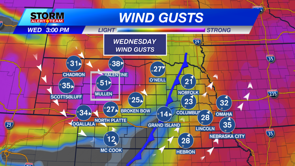
A WINDY & mostly sunny day across Nebraska High temperatures statewide ranging from 52° – 70° with dew points in the 20-> 40s! Fire weather concerns out west due to DRY conditions & gusty winds.

SW->NW wind gusts up to 35-50+ mph across much of the state. The strongest winds in the sandhills.

Wind gusts will be strongest today & Friday. SW wind gusts could exceed 40-45+ mph both days. ENJOY Thursday as winds relax and sunny skies takeover. Friday & Saturday, winds return to gusting near 30-45 mph.

Saturday afternoon/evening brings the BEST chance for light rain. A cold front will sweep through bringing rain across eastern & SE Nebraska with COLDER air following behind!

TUESDAY–WEDNESDAY: November 24-25: A light rain/snow mix is possible across E/SE Nebraska. We will monitor this system through the weekend. Travel impacts look minimal.

High temperatures look to stay near 47° – 67° through the next 10 days! *Morning temperatures look to cool near 21° – 32°! Expect WINDY conditions through Wednesday & again on Friday & Saturday. The BEST rain chance comes Saturday afternoon/evening. A rain/snow mix possible Tuesday into Wednesday. Thanksgiving week looks colder than normal. Stay tuned for the latest.

Meteorologist Houston Hall
Facebook: HHallWX
YouTube: HHallWX


