Still Sunny, Warmer on Sunday

Another sunny day awaits on Sunday as high temperatures gain a few degrees compared to the start of the weekend. Winds continue to get lighter, shifting out of the east by Sunday afternoon.
The latest runs of StormCast keep cloud cover out of the area for the most part. There is a chance for patchy areas of fog early on Sunday morning, especially in low-lying areas.

Temperatures will start in the upper 50s to lower 60s on Sunday morning under mostly clear skies.

Winds should continue to decrease as we head through the overnight hours in Lincoln. Overnight temperatures will fall to the lower 60s.

In a similar story to Saturday, eastern Nebraska remains cooler for Sunday afternoon with highs in the 80s. Better chances for the 90s and potentially triple digits the further west you go.

Close to average for our high temperatures in the Capital City for a Sunday in early August. We will see temperatures reach the upper 80s with lighter winds throughout the afternoon.

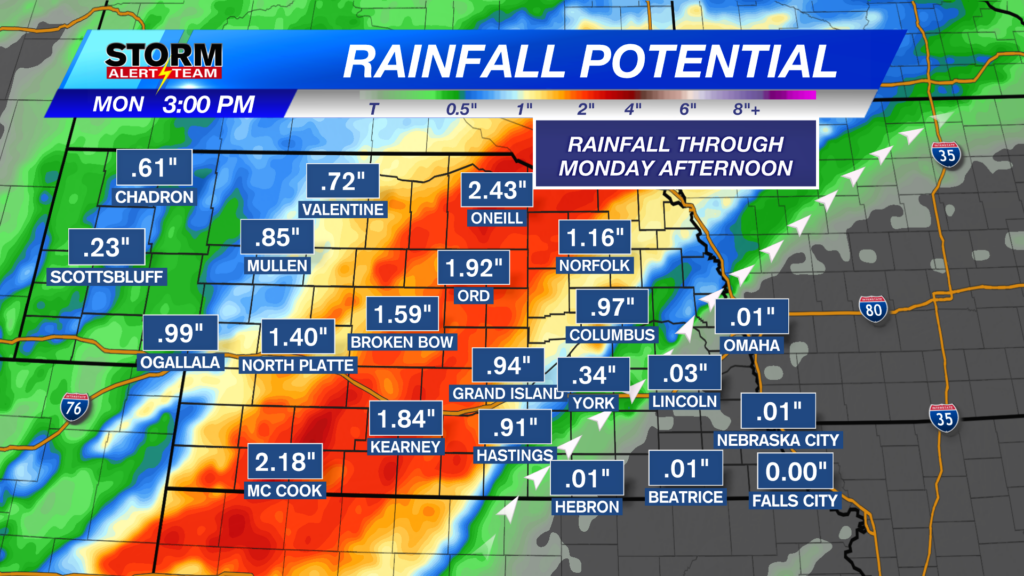
Chances for showers and thunderstorms arrive in central and western Nebraska before moving east through the days to follow. There is a Marginal Risk (Level 1 out of 5) of severe weather in place on Monday evening, when isolated severe storms will be possible.
An early look at models shows isolated storms possible for central Nebraska late Monday evening. Additionally, storm chances increase for southeast Nebraska on Tuesday morning.

Monday sees high temperatures return to the 90s before chances for showers and thunderstorms knock our afternoon highs back down to the lower and middle 80s. Seasonal weather returns for the end of next week and into the following weekend.
Storm Alert Team Meteorologist
Dominic Ferraro
X: DomFerraroWX
Facebook: DomFerraroWX
YouTube: DomFerraroWX