Winter making a comeback to close out the week
Thursday marks the 3rd consecutive day where Lincoln has exceeded 50° for a high temperature. That is the 57th time that this has ever happened in the month of January since 1887! Going forward, it does not look like Lincoln will see a 4th day above 50°.
Clouds will thicken on Thursday night. We’re waking up to overcast skies on Friday morning, with overnight lows near 31°.
There may be just enough moisture to produce a few pockets of mist in the morning. With air temperatures just slightly below freezing, the mist may be able to freeze on contact with any subfreezing surfaces. However, since we’ve been so warm in recent days, we’re not likely to see widespread freezing mist on Friday morning.
Overcast skies remain into Friday afternoon. Highs should be cooler, near 42° in Lincoln. We are eyeballing our next storm system which gives us our next best chance for precipitation starting Friday afternoon.
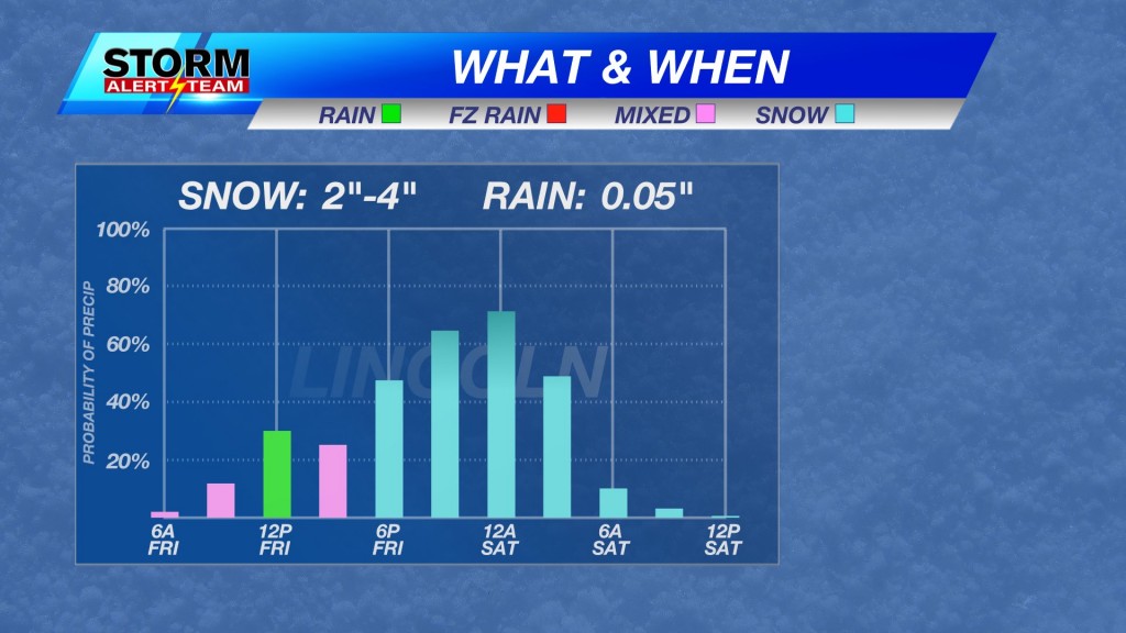
Around lunchtime, there is a chance to see a few isolated rain showers which should persist into the afternoon. As we get closer to the late afternoon and evening commute, the rain should begin to transition to more of a wintry mix before changing over to snow altogether on Friday evening.
The best chance to see accumulating snow will likely be sometime between 1AM to 5AM Saturday. Keep in mind that wind gusts increase to near 40mph at times on Friday night. That could allow for some blowing snow at some points. We expect most snow activity to cease on Saturday morning.
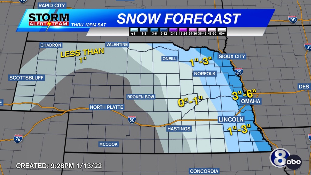
The bulk of the moisture will fall to our east, and that is where the higher accumulations are likely to be. We’re looking at the possibility of 1-3″ in Lincoln, with totals quickly dropping off to the west. Areas west of Seward may see as little as nothing and as high as 1″ depending on how far west you are located.
Clouds begin to clear, and we turn drier for Saturday afternoon. It should be a much cooler start to the weekend with highs in the 20s on Saturday.
Meteorologist Malcolm Byron
Facebook: /mbyronwx
Twitter: @mbyronwx


