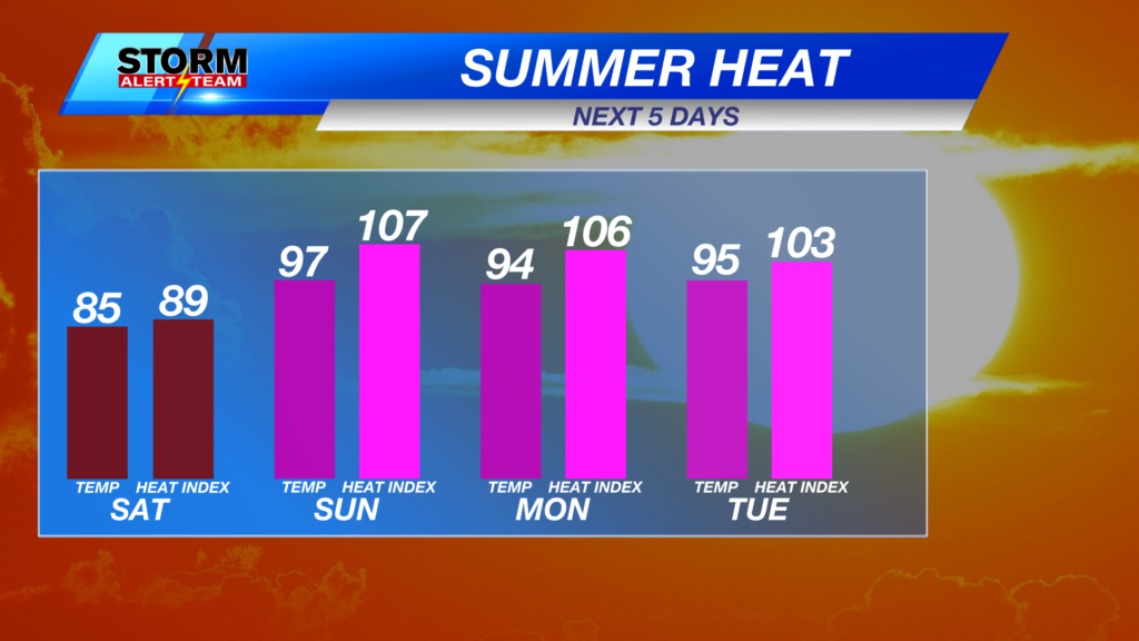
Fire Weather, Rain Chances and Record Highs Possible on Tuesday

The risk for fire weather peaks across the state on Tuesday with several fire weather alerts in place. Low humidity, strong winds, and prolonged drought mean any fires that ignite will grow rapidly and be very difficult to contain. A Red Flag Warning is in effect for much of the state from 12 p.m. until 8 p.m. CST.

Temperatures tonight will be very mild with overnight lows in the 40s.

Mostly cloudy skies are expected for a mild and calm evening ahead in Lincoln.

The warmest day of the calendar year looks to arrive on Tuesday with forecast highs in the middle to upper 70s.
Lincoln has a good chance at seeing a record high on Tuesday. 78° would not only set a new record high but would enter the top 5 for all-time February high temperatures record in the Capital City.
Very windy across the state on Tuesday, here is a look at when the strongest winds could reach your area.
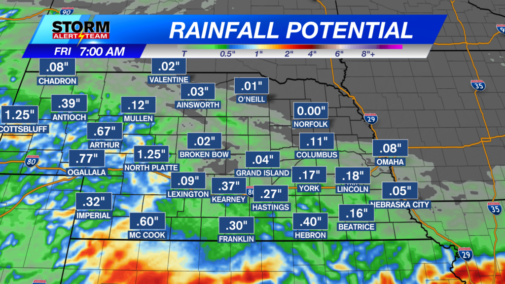
Much needed moisture looks to head our way later this week. StormCast shows a chance for showers, and possible a thunderstorm on Tuesday evening, followed by rain and snow chances late Wednesday into Thursday.

We finally look to cool down later this week with temperatures falling to the 40s by Thursday. Wintry precipitation chances could continue through the end of the work week, before sunshine returns for the last week of the month.
Storm Alert Team Meteorologist
Dominic Ferraro
X: Dom_FerraroWX
Facebook: DomFerraroWX
YouTube: Dom_FerraroWX