Several storm chances through the week
For up to the minute radar, go HERE.
For the latest warnings, go HERE.
For a live look at our Nebraska Weather Cams, go HERE.
And we would love to see video of any storm footage you may get (safely!). You can upload that using our Now Local News App HERE.

Storms are possible for just about everybody across Nebraska Wednesday evening, including SE Nebraska, but the better chance for severe storms will be in the green shaded area (above). It’s here that a few strong to severe storms with 1″ hail and 60 mph wind gusts will be possible.

Temperatures will generally be around 80 degrees on Thursday, which is pretty close to normal.

We do have another chance for severe weather on Thursday, as well.
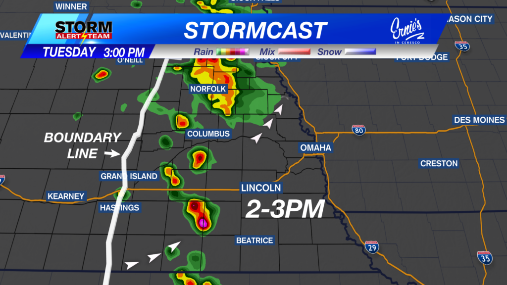
Above is what our StormCast weather model is saying for timing, duration, and location of the storms on Thursday.

We also have a severe weather threat on Friday, but this time, the level 2 “Slight Risk” is right over the top of central and eastern Nebraska. Large hail and damaging wind are possible as well as a quick spin up tornado or two.
Above is what our StormCast weather model is saying for timing, duration, and location of the storms on Friday.

After a hot but dry day on Saturday, more storms will be possible Sunday and Monday, then dry most of next week.
Chief Meteorologist Rusty Dawkins
Facebook: RustyWx
YouTube: RustyWx
TikTok: RustyWx
BlueSky: RustyWx
Instagram: RustyWx
Threads: RustyWx
Twitter: RustyWx