Remaining mild, scattered showers possible
Cooler air has moved into a good portion of Nebraska, but SE Nebraska remains mild. This will continue for a while. Rain chances move from west to east as we head into next week.

The battle of the air masses continues on Sunday. 40s and 50s to the west, 60s and 70s to the east.

This continues into Monday with warmer air actually winning a little bit, pushing further north.
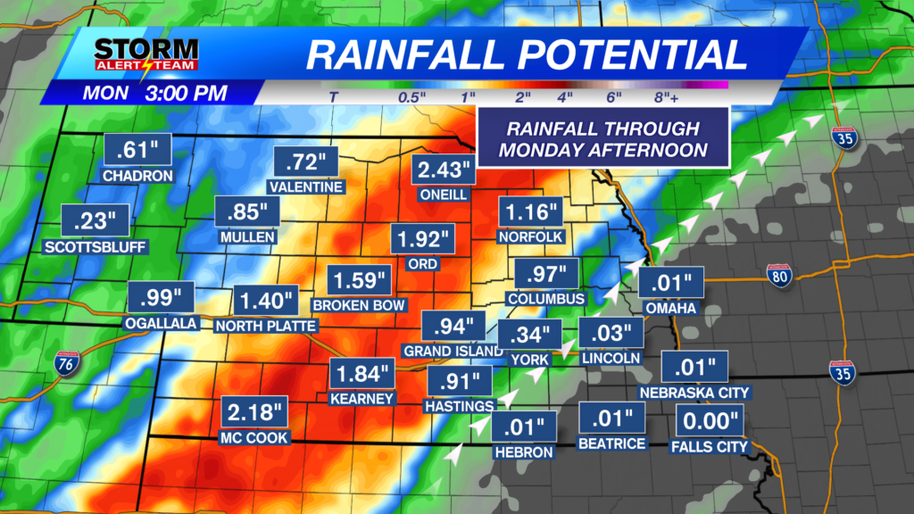
Rain chances are out there for the next few days, but you’ll need to be in the right spot to see rain. See above for what our latest StormCast weather models shows for timing and location. Keep an eye on NW Nebraska Monday… could see some snow!

By noon on Monday, the heaviest rain will have fallen in the western half of the state. Eastern Nebraska will be on the edge of rain vs no rain.

Chief Meteorologist Rusty Dawkins
Facebook: RustyWx
YouTube: RustyWx
TikTok: RustyWx
BlueSky: RustyWx
Instagram: RustyWx
Threads: RustyWx
Twitter: RustyWx